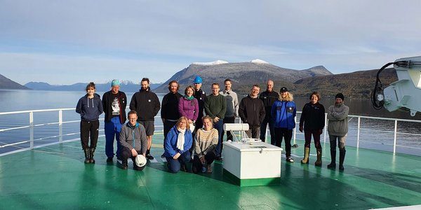
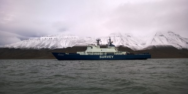
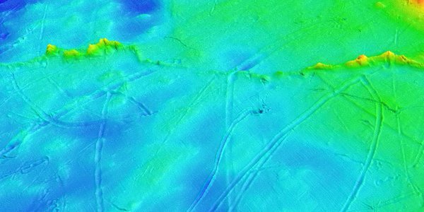
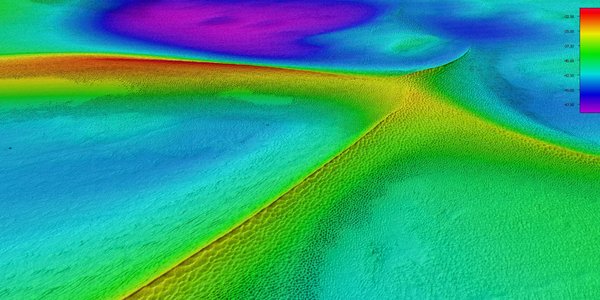
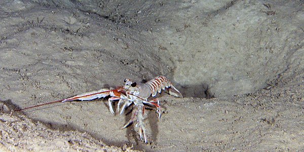
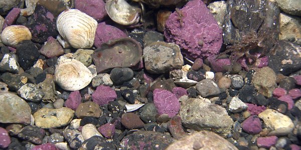
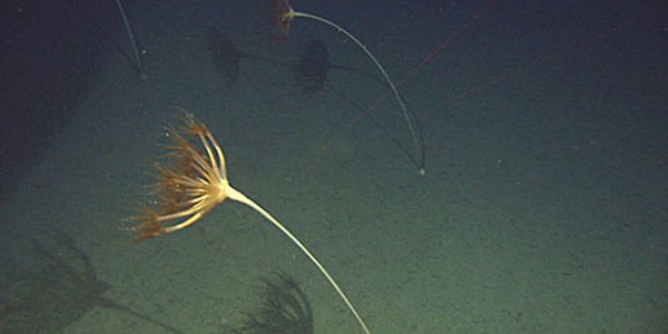
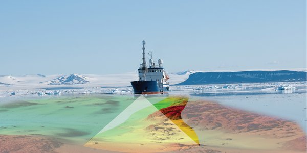
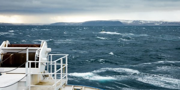
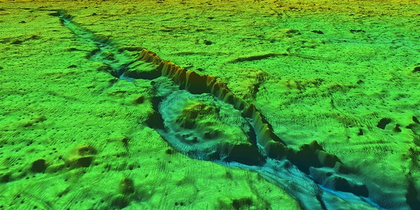
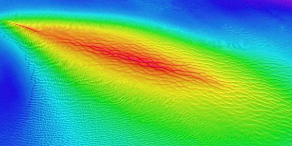
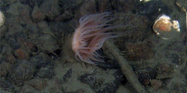
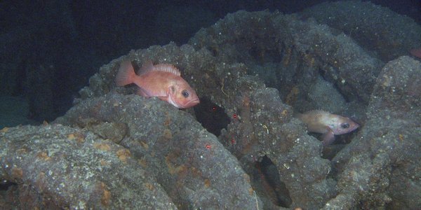
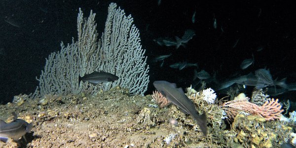
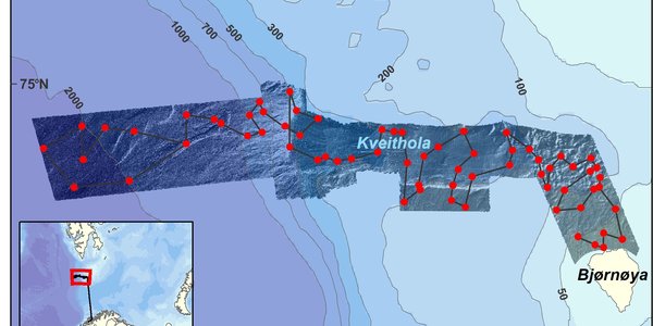
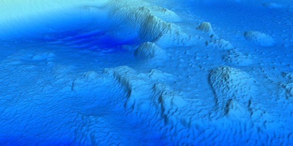
Goto main content

News

Result: (151) Showing 31 - 60

VB erosion hoved

Current events at Aktivneset

27.04.2021

Cruise diary: After 16 hours transit from Garsholbanken, we arrived at a new sampling area, west of Aktivneset. This place is special as it is located at the outer part of the Norwegian Channel, a channel that starts south of Oslo and curves around Norway, before reaching Aktivneset.

fgmg 2020 TR TF2 NS05 celle001 B

New Tender for Bathymetric Mapping in 2021

07.01.2021

The MAREANO programme will continue the bathymetric mapping in the Barents Sea this year, although only three smaller transects. A new tender competition for bathymetric mapping was published 8 March 2021.

Primnoa Lophelia sei Sklinnab justert  R2293

The MAREANO survey continues to the Sklinna Bank off mid-Norway

31.07.2020

Cruise diary: The ongoing MAREANO survey has now moved southwards from the Træna Bank to the Sklinna Bank on the mid-Norwegian shelf. The seafloor terrain here varies more than farther north, and we have found hitherto unregistered cold-water coral reefs.

Valerie fig4 nett

Horseshoe and cold-water coral reefs

29.07.2020

Cruise diary: In the framework of this year´s seabed mapping on the Norwegian continental shelf, R/V "G.O. Sars" arrived on Trænabanken last week.

Fig 1 IMG 9024

Seabed mapping in the Norwegian Arctic

05.11.2019

Thursday afternoon, on the 10th of October, RV G.O. Sars left Tromsø harbour, heading for Kvitøyrenna, a bathymetric trough located between the islands Storøya and Kvitøya within the eastern part of the Svalbard archipelago. It is a long way from Tromsø to Kvitøya, and the transit was planned to take two and a half day. However, the trip took even longer when a northerly wind picked up.

valerie fig3c

Shallow, but beautiful

30.10.2019

MAREANO is currently on cruise gathering visual and physical seabed samples from several areas around the Svalbard archipelago in the Norwegian Arctic. At the moment we are back in outer Kongsfjordrenna trough, offshore of northwest Svalbard, after a couple of days working closer to shore in Kongsfjorden due to poor weather. Here we tell you a little bit about what we have seen here.

e Umbellula

New general biotope map for the Barents Sea

24.10.2019

Mareano has now published an updated general biotope map for the Barents Sea. This map more than doubles the area for which biotopes distribution has been predicted in this area, and provides the first indication from Mareano results of distinctive habitats occurring in Arctic waters and north of the Polar Front.

bilde2

MAREANO side event at Our Ocean 2019 Thursday 24 October 7.30-8.30 AM

22.10.2019

The Our Ocean 2019 conference is being held in Oslo 23-24 October 2019. The conference brings together leaders from governments, businesses, civil society and research institutions to share their experience, identify solutions and commit to action for a clean, healthy and productive ocean. Several side events are open to the public, including our event named “MAREANO – A Unique seabed mapping programme”.

Alle stasjoner Mareano 2010106 engelsk

MAREANO cruise summary: To Bjørnøya, beyond, and beneath!

26.09.2019

Saturday 6th April, a crisp, bright morning in Tromsø and 15 scientists and engineers from the Institute of Marine Research (IMR) and the Geological Survey of Norway (NGU) join the crew onboard G.O. Sars and set sail for Bjørnøya (Bear Island), where we will survey an area of around 4 500 km2 extending as far as 75°N in the western Barents Sea and Norwegian Sea.

20170620 092230 Programmering USV Otter

Testing Autonomous Mapping

01.07.2019

New sensor platforms, such as autonomous vehicles and drones, open up new possibilities for mapping the terrain, sediments and habitats in shallow waters and the foreshore. In June MAREANO teamed up with NTNU-AMOS to test out unmanned and autonomous platforms for interdisciplinary mapping. 

boat

New Tender for Bathymetric Mapping in 2018

21.12.2017

The MAREANO programme will continue the bathymetric mapping in Svalbard, the Barents Sea and the Norwegian Sea in 2018. A new tender competition for bathymetric mapping was published 16 December 2017.

2017 05 kart 541 ny

New Nautical Chart on Svalbard

27.06.2017

A new chart covering waters north of Nordaustlandet, has been published. This main chart is named “no. 541 Nordporten–Sjuøyane”. MAREANO and the Norwegian Mapping Authority Hydrograophic Service surveyed the fairway to Rijpfjorden in 2016.

Muddersjostjerna paa havbunnen og ombord

In a Sea of Stars

07.04.2017

Mud Stars are important as they burrow down into the mud, helping to oxygenate the sediment and stimulating microbial growth, which contributes to nutrient cycling and release. They also feed on the organic matter present within the mud, hence the name Mud Star.

Barentshavet east nitall

MAREANO Live at the UN

28.03.2017

This Norwegian seabed-mapping program is a provider of knowledge for blue growth. Watch the live stream when MAREANO presents itself at the UN 28 March.

3d rygger spitsbergen 30 40m dyp meritaito 1m grid

Rich Formations on the Seabed of Spitsbergenbanken

11.01.2017

Now we are able to reveal how the landscape curves itself on the bottom of Spitsbergenbanken on Svalbard. In 2016, the Finnish firm Meritaito has been conducting bathymetric mapping on Spitsbergenbanken and in the Barents Sea, organized by the MAREANO programme.

Rijpfjorden

The Fairway to the Rijpfjord Surveyed

04.01.2017

– MAREANO has planned to survey the Rijpfjord in Svalbard in 2017 and 2018. Therefore, the fairway into this arctic fjord was surveyed in 2016, says Hanne Hodnesdal at the Norwegian Hydrographic Service.

TOO E grid05m 13 web

Tender for Bathymetry Mapping Published

20.12.2016

MAREANO is continuing the surveying of the Barents Sea and waters around Svalbard. A new open tender invitation for bathymetry mapping was published 14 December 2016.

sjomaling 500

Tender for Bathymetry Mapping to be Published in December

17.10.2016

Plans for bathymetry mapping in 2017 and beyond are made, and in early December a new tender invitation for bathymetry mapping will be published.

photo of panel with 5 people

MAREANO Presented to The World Bank Group

19.09.2016

The MAREANO-programme’s work and results was presented at the World Bank Group's seminar "Knowledge for Blue Growth: Norwegian contribution to a sustainable ocean economy", in Washington D.C.

multicore

MAREANO's chemical data are available in one separate data file

18.08.2016

All the analytical data from the MAREANO Chemistry Program for 2003-2013 are compiled into one database which can be downloaded. The data file will be updated in January each year.

nye ledere

Leaders of the Mareano Programme Group and the Executive Group hands over the baton

13.06.2016

During last week there was a change in leadership within the Programme Group (executive heading) of Mareano when Signe Nåmdal (Norwegian Environment Agency) replaced Aksel Eikemo (The Directorate of Fisheries). The group has the superior responsibility regarding implementation of the different activities in Mareano. Also the Executive Group (doing the daily operations in Mareano) did alter its leadership and here Sten-Richard Birkely took management in the group replacing Børge Holte (both from the Institute of Marine Research).

geobiokjemi 2016

MAREANO's 2016 field surveys in the Barents Sea and around Svalbard

31.05.2016

MAREANO's 2016 campaign of hydrographic surveying began in February mapping the area between Bjørnøyrenna and Sørkapp, on Svalbard. Later this year bathymetric data acquisition will continue in the Barents Sea at the Norwegian side of the agreed Delimitation Line between Norway and Russia. Bathymetry data will also be acquired along the north coast of Svalbard, starting this year with surveys of the passage to Rijpfjorden. During 2016 there also will be two cruises for geological, biological and chemical sampling. The first cruise starts in June and will sample the new Norwegian area adjacent to the Norwegian/Russian Delimitation Line. The second cruise is bound for the area from Bjørnøyrenna to Kong Karls Land, to the southeast of Svalbard, and will be conducted in September – October.

mareano bok

New book from MAREANO

04.12.2015

In the occasion of MAREANOs 10th anniversary, a new book presenting the results of the mapping and surveys of the Norwegian sea floor has been released. The book, which is in English, is an expanded and updated version of the Norwegian book from 2010.

Gruppe bilde

Mission Accomplished — yet another successful cruise!

09.09.2015

Cruise diary: During the course of two weeks the biology and geology was mapped at 73 locations along the shelf edge west of the town Sandnessjøen at depths ranging between 220 and 760 meters. At 14 of these sites, a total of 83 bottom samples were collected using grabs, cores, sleighs, and beam trawls. At all sites the seafloor was investigated and documented using the Chimaera video rig (Chimaera is the Latin name for the rabbit fish/rat fish).

R1564VL1613 00 41 24

New coral reefs discovered off Northern Norway

08.09.2015

Cruise diary: During the past two weeks of the MAREANO expedition, several new coral reefs have been discovered. One of them is Pearl Chain Reef (Perlekjederevet) that was found west of the town Sandnessjøen, at a depth of approximately 290 meters. This is a narrow coral reef complex extending over a kilometer in length.

Snitting

Looking for pollution in the Norwegian Sea

03.09.2015

Cruise diary: The ongoing MAREANO cruise has finished surveying the shelf edge south of Skjoldryggen at the mid-Norwegian shelf, and is now concentrating on the shelf edge between Skjoldryggen and Trænadjupet. Sediment samples have been collected from ten locations, including five with multicorer.

R1536VL1585 00 29 25 02b

The deep-sea seapen Umbellula: cheek to cheek in the deep sea

01.09.2015

Cruise diary: One of the most spectacular creatures that we occasionally encounter down in the deep, cold ocean is the deep-sea seapen Umbellula encrinus. This spectacular organism, resembling a giant plant or exploding fireworks is in actual fact a colony of giant polyps, which are collected in a crown perched atop a stem, of sorts.

Fig1 NO

Cracks along the upper slope directly north of the Storegga Slide

01.09.2015

Cruise diary: Between stations, the vessel G.O. Sars collects high resolution seismic data using a hull mounted acoustic source (TOPAS). In fine-grained sediments the sound may penetrate 100-150 m. The acoustic pattern gives an indication of the seafloor sediment type, but we also get information about the stratigraphy and geological development.

fig4

Large areas of carbonate crust found at pockmarked seafloor off mid Norway

28.08.2015

Cruise diary: On a 700 m long video line on the outer shelf close to the Storegga Slide (Figure 1) numerous blocks of carbonate crust were found at a 400 m long section (Figure 2). The carbonate crust appears to correspond with areas of high backscatter.

svampsamfunn

The seacrets of the shelf edge

27.08.2015

Cruise diary: Thanks to the good weather with almost flat sea the mapping around the shelf edge off Trøndelag and Nordland has proceeded nicely without delay. The video documentation and bottom sampling in the southern mapping area is now finished.