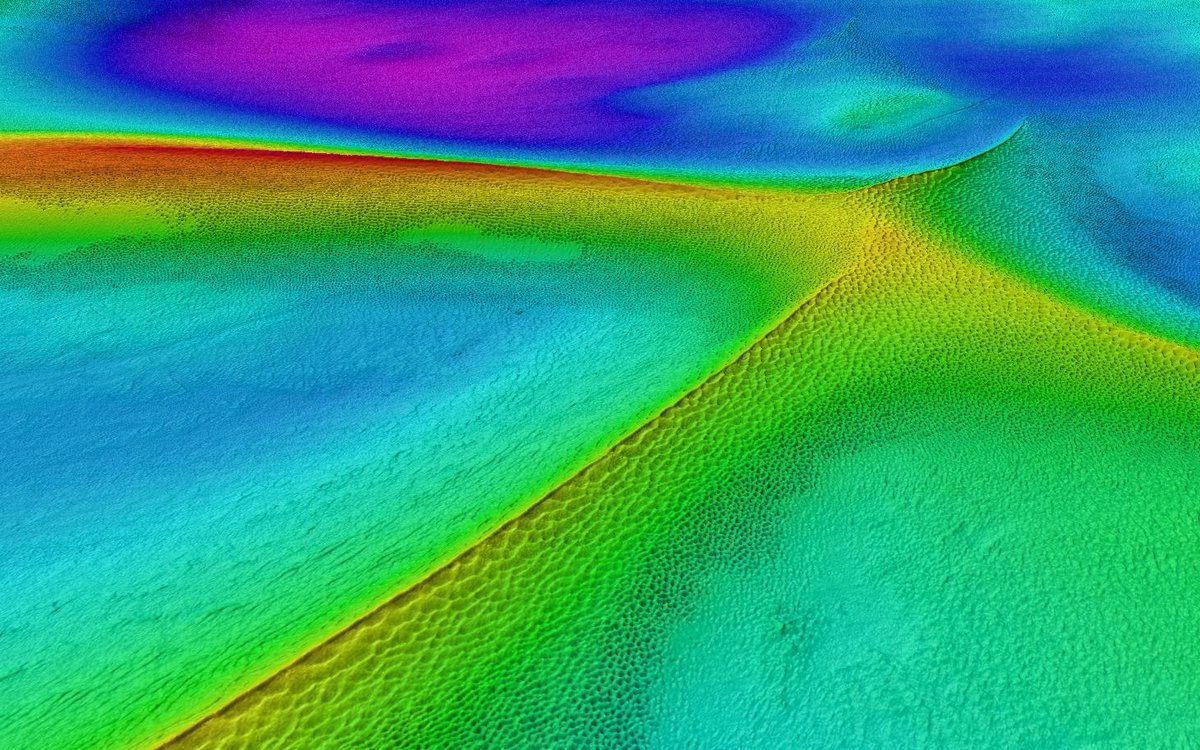
Sand dunes at a depth of 40 meters on Spitsbergenbanken, formed by strong bottom currents. The resolution is one meter grid (1 meter intermediate depth points). Terrain model: Kartverket / Mareano
Photo: Kartverket/Mareano
Sand dunes at a depth of 40 meters on Spitsbergenbanken, formed by strong bottom currents. The resolution is one meter grid (1 meter intermediate depth points). Terrain model: Kartverket / Mareano
Photo: Kartverket/MareanoPublished: 05.07.2021
MAREANO is a national, interdisciplinary programme which objective is mapping the Norwegian ocean floor. The mapping data includes bathymetry, seabed substrate, biodiversity, natural habitats and sediment contamination, and supplies up-to-date knowledge tomanagement agencies, industry, academia and the general public.
To date a total of c. 287660 km2 of bathymetry data have been acquired by MAREANO. Additionally, bathymetry from external parties have been used. The bathymetry forms the basis for the planning of sampling cruises and the mapping of the geological, biological and chemical environmental conditions of the seafloor. Up until now, a total of 229613 km2 of seafloor have been sampled in the field regarding its geology, biology and chemistry. High resolution bathymetry data are also important for the modelling of nature types and biotopes, as well as potential occurrences of cold-water coral reefs.
Bathymetry surveys:
Geological, biological and chemical sampling:
Based on the results of the contamination study (reported in 2019) the traditional sampling tubes have been replacedwith steel tubes especially developed for microplasticsampling.
Potential coral mounds: The method was further developed in 2020 and now includes a semi-automatic step that extracts areasfor further analysis, increasing the efficiency of the method.