Goto main content

Topics

Backscatter screenshot Norsk

Acoustic backscatter

Acoustic backscatter data give a useful indication of harder or softer areas of the seabed. MAREANO acquires multibeam backscatter data and these data  are invaluable in the production of classified sediment maps.

boat

Bathymetric Mapping

The Norwegian Mapping Authority Hydrographic Service is responsible for acquiring bathymetric data in areas which are to be mapped by the MAREANO programme.

model and photo of life at ridges

Bioclastic sediments

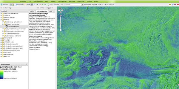
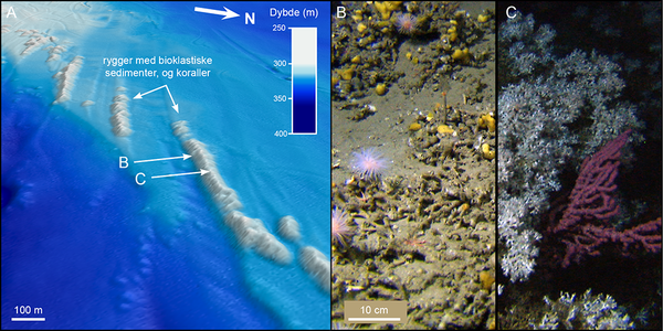
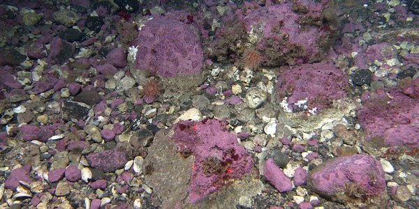
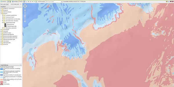
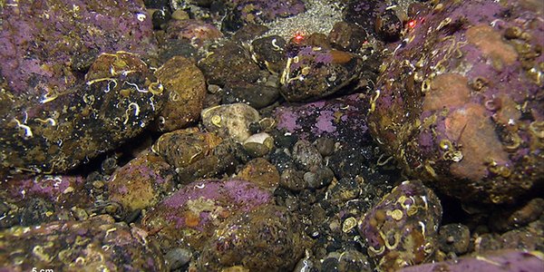
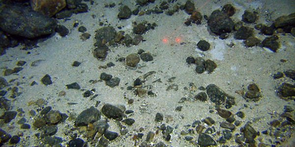
Bioclastic sediments is a term used to describe carbonate rich sediments consisting of fragments/shells of dead organisms. On the continental shelf, we find bioclastic sediments with a high content of the remains of stony corals. These sediments form mounds and ridges in many places, which may be associated with live corals.

Metopa glacialis

Biodiversity

Biodiversity is a general term used to describe the diversity of life forms, species and the communities that they form.

arsen kart

Environmental chemistry and pollution

The seabed receives contaminants from the environment, and sediments become a significant  storage place for pollutants. Sediments can therefore be a source of pollution in the fjords and of the uptake of contaminants by biota.

cobbles with purple tint

Habitats

Norway has a varied marine environment, comprising contrasting landscapes ranging from the deep sea mountain chains in the mid-Atlantic to the skerrygaard and fjords of the coastal zone. Within each of these landscapes there are many different seabed habitats.

model showing marks on seabottom

Marine landforms

A wide variety of landforms made by geological process are found on the sea bottom. The landforms tell us how the seabed is formed, and what sedimentation processes are active today.

map

Marine landscape

MAREANO maps the large scale marine landscapes of the seabed. We use an automated GIS classification following the definitions of Naturtyper i Norge (NiN, Nature types in Norway).

NorKyst800 UVmean 2010 web

Modelling of bottom currents

The bottom currents have a large impact on the sea floor and the animals that live there. It is difficult to measure the bottom currents over large areas, but improved models have now opened up the ability to estimate the bottom currents at reasonable accuracy. In MAREANO, the results are used in mapping the nature types.

kartutstnitt sedimentasjonsmiljo

Sedimentary environment

The seabed is shaped slowly by a variety of geological processes, over thousands of years. The map of sedimentary environments shows which processes influence and shape the seabed we find today.

grus sveinsgrunnen

Sediments (genesis)

The composition of sediments, the landforms they create, and where they are located, tell us which processes shaped the seabed as it is today.

m Fig 6 Stony sand bottom

Sediments (grain size)

What types of material cover the sea floor? What makes some areas well-suited for corals and sponges to anchor to, while other areas are teeming in crabs and starfish? The bottom type is important characteristic of an area; therefore, NGU’s Sediments (grain size) map is our most requested product.