When mapping the seabed and producing a map over seabed sediments (grain size) we choose amongst more than thirty classes of grain types. Mapping is performed in line with Mareano's Standard for geological seabed mapping offshore and in accordance with standard procedures for map production and quality control. Sediments usually consist of mixtures of several different grain sizes, with each combination constituting its own class of sediment types, in addition to pure types, like sand.
Here are description of a few classes used when producing the Sediment (grain size) map:
- Mud: Fine-grained, homogeneous sediments comprised of clay and silt. Occurs in a few depressions on the continental shelf where bottom currents are weak.
- Gravelly sandy mud: Poorly-sorted sediments mainly composed of clay and silt, but mixed with varying quantities of sand, gravel, and cobbles. This type of seabed occurs in areas of the continental shelf and the continental slope where bottom currents are relatively weak.
- Sand: Particles dominate the sand fraction, but it may contain small amounts of gravel and/or mud. It is a product of erosion and associated with bottom currents. This type of seabed appears in areas of the continental shelf and the continental slope where the intensity of sea currents decrease. Sand is found on the continental shelf as well as on the continental slope.
- Gravelly sand: Sand is the predominant grain size, but this type of sediment also contains significant amounts of gravel and pebbles. Gravelly sand is common on both the continental shelf and continental slope, and occurs in areas with relatively strong bottom currents, which are able to transport sand.
- Sandy gravel: Gravel is the dominant particle size, but this type of sediment also contains significant amounts of sand. Sandy gravel is common in areas, on the continental shelf and on the continental slope, with strong bottom currents.
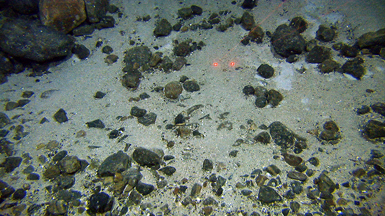
- Gravel, cobbles, boulders: Gravel, cobbles and boulders dominate, with only small amounts of sand and/or mud. This bottom type occurs most often in areas where strong bottom currents prevent deposition of fine-grained sediments, or they are washed out/eroded away. This bottom type is common in bank-areas of the continental shelf.
- Compacted sediments or sedimentary rocks: Exposure of compacted sediments or sedimentary rocks on the seafloor. These may be old sediments compressed and deformed by glaciers or sedimentary rocks that originated several million years ago. They are often found in steep areas of the continental slope.
Particle size is interpreted by the following techniques: Landforms (from multibeam bathymetry), backscatter (from multibeam bathymetry), photographs and video films of the bottom, bottom samples taken with grabs, box corers, sledges, multicorer and shallow seismic data. The classification of sediment types is determined by the scale of the map produced and the degree of detail in the data used during the interpretation and the map compilation.
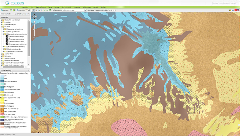
Screen capture of Sediments (grain-size) map from Mareano.