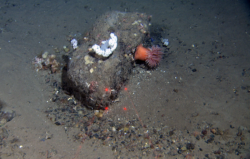
Strong erosion on the up-current side of the stone with a small comet mark behind it – 500 m depth. The stones not only provide a stable substrate for sponges and other attached organisms but may also serve as shelter and resting places for fishes. Here they can stay still without having to swim against the currents all the time. The distance between the red laser dots is 10 cm.
Current events at Aktivneset
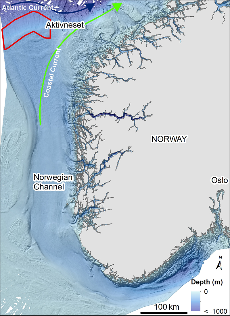
Cruise diary: After 16 hours transit from Garsholbanken, we arrived at a new sampling area, west of Aktivneset. This place is special as it is located at the outer part of the Norwegian Channel, a channel that starts south of Oslo and curves around Norway, before reaching Aktivneset.
Published: 27.04.2021Author: Valérie Bellec, Pål Buhl-Mortensen, Daniel H. Wiberg, Henning Jensen, Liv Plassen
This deep channel (~700 m deep at its deepest and ~500 m deep in our area) has been eroded by ice streams which drained a large part of the southern region of the Scandinavian ice sheet during glaciations. Through time the Norwegian channel ice streams have transported enormous amounts of eroded sediments and while some of them was deposited at Aktivneset, the majority continued down the continental slope as debris flows – building the gigantic North Sea fan.
Two major currents meet in this area, the deep (from surface down to about 700 m depth) and warm Atlantic Current, and the shallower Coastal Current (down to around 50 m depth).
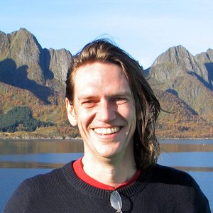
The second study area of the Easter Mareano cruise is located at the outer part of the Norwegian Channel and west of Aktivneset (red polygon). Bathymetry data from Mareano/Kartverket and Olex.
In a way, Aktivneset is where the Atlantic Current first hits Norway. The shape of the North Sea fan steers and accelerates the currents here. The first videos west of Aktivneset showed indications of strong currents, and based on the particles moving over the laser scale on the video rig we estimated a current speed often around one knot. These strong currents created well-developed bedforms.
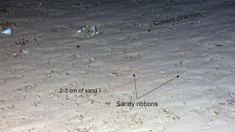
Bedforms are made of sediment that are transported and shaped by currents. There are two main types of bedforms: longitudinal bedforms oriented more or less parallel to the current direction (e.g. sandy ribbons or comet marks), and transverse bedforms oriented perpendicular to the current direction (e.g. ripples). The most widely known of the bedforms are ripples, which often form at sandy beaches. But they also occur in much deeper environment, like here at about 500 m depth.
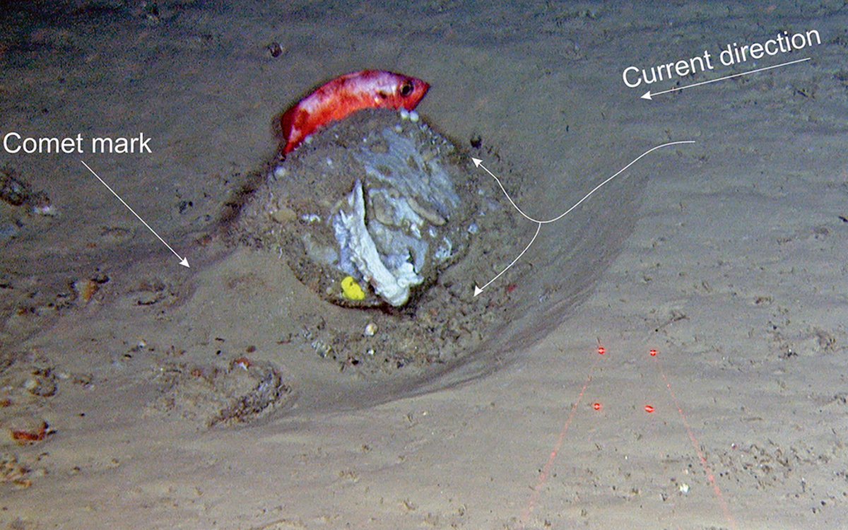
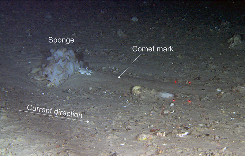
Bedforms occur when the currents start moving and sorting the sediments. The finest sediment (often sand) is transported and deposited in areas of lower currents, e.g. behind an object (comet marks), or on the lee side in case of ripples. Sediment accumulation also occurs where currents converge, like in the case of sandy ribbons.
Conversely, where the currents diverge, erosion occurs. This erosion and deposition pattern is clearly demonstrated around stones and large sponges, where erosion is observed on the up-current side, and comet marks on the lee side.
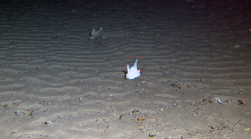
In areas with enough sand, bedforms cover most of the seabed. Examples of these are sand ripples or sandy ribbons. Where too little sand is present only comet marks are observed.
Ripples at about 500 m depth – perpendicular to the main currents. The steep slope indicates the direction of the current (towards us in the image). Various sponges are attached to stones elevated from the surrounding sediments. In this position they are offered a stable substrate and stay clean of the moving sediments. The distance between the red laser dots is 10 cm.Sandy ribbons at about 500 m depth – parallel to current direction. The distance between the red laser dots is 10 cm.
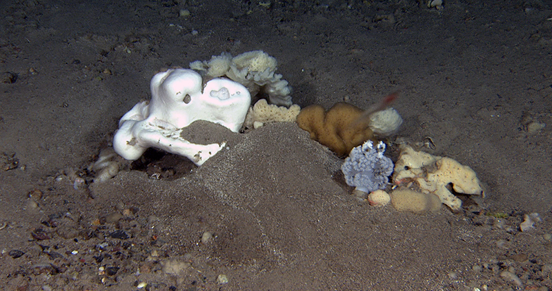
Long comet marks behind sponges and stones with sessile fauna at about 400-450 m depth. The biodiversity is higher on the stones, like oases in the desert. The moving sand may cause problems for the attached organisms, when it accumulates over the surface of sponges and clogges their filtering structures. On the lower big stone, we observed cauliflower corals, a sea anemone and various encrusting sponges. The distance between the red laser dots is 10 cm.
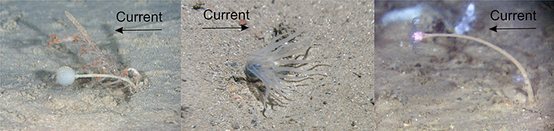
Strong currents can be recognised on video by closely inspecting seabed-swelling animals. Flexible organisms may be a good indicator of both current direction and speed. The delicate tentacles of tube anemones wave and flutter in the currents, and stalked animals like lollipop sponges and hydrozoans bend over more and more with increasing current speed, in the direction the current is flowing.Summary of different bedforms found in the eastern part of the survey area west of Aktivneset (red polygon). Bathymetry from Mareano/Kartverket.