
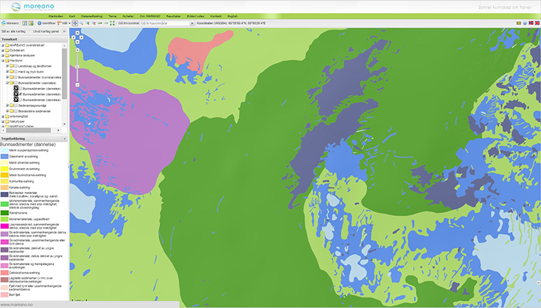
Sediments (genesis)
The Sediments (genesis) map reveals processes that started at the end of the last Ice Age, thousands of years ago. Classifying these sediments involves looking at landforms, grain size, photographs and video footage, grab samples, box corers, sledges and multicorers, and seismic data. Mapping is performed in line with Mareano's Standard for geological seabed mapping offshore and in accordance with standard procedures for map production and quality control. The following are some examples of classifications that are used in this mapping:
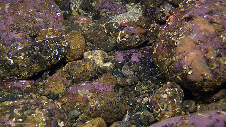
Moraines. Terminal moraines were formed at the end of the last Ice Age by glaciers, either as ridges in front of glaciers (end moraines) or along the sides of the glaciers (lateral moraines). The most typical type of moraine contains sand, gravel and cobbles in its uppermost layer. The thickness of the uppermost layer can range from a few centimetres to decimetres and represent the outwash layer or an erosional remnant (lag) left standing after bottom currents transported the most fine-grained sediments away.
Marine suspension deposits. In calm submarine environments, fine-grained sediments that have been dispersed in water columns settle on the seafloor. These marine suspension deposits are found locally in troughs between the banks and in deeper areas, often directly above till. Pockmarks are mainly found where the bottom consists of marine suspension deposits.
Bedload (traction) deposits. Marine bedload deposits are characterized by sand that has been transported along the bottom by ocean currents. They are found in places where the currents decrease in strength, which includes slopes, lee sides of ridges, and localized as sandbanks, in channels and shallow waters. Sand waves and sand dunes are common structure found on the sandbanks.
Contact

Lilja Rún Bjarnadóttir
Geological Survey of Norway
Geological mapping
Geologist
944 97 728