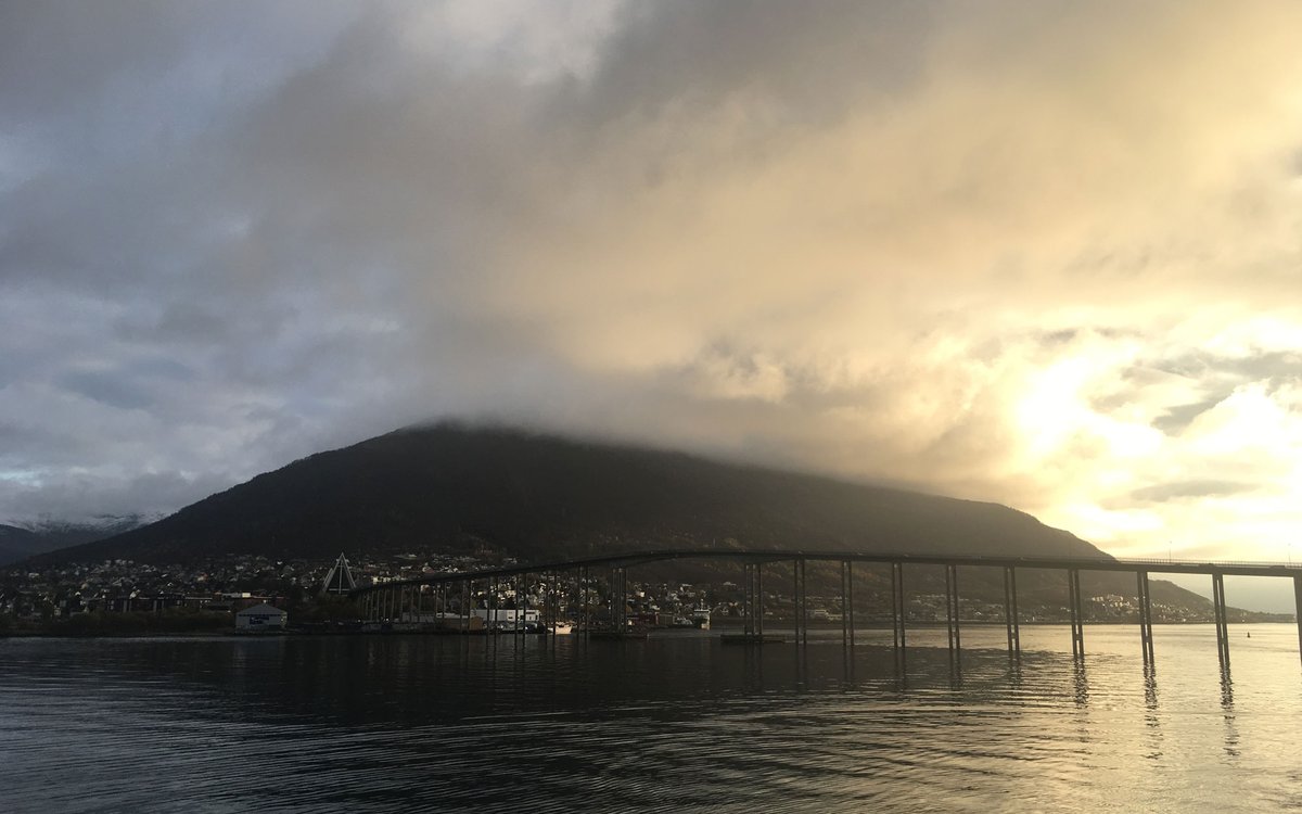
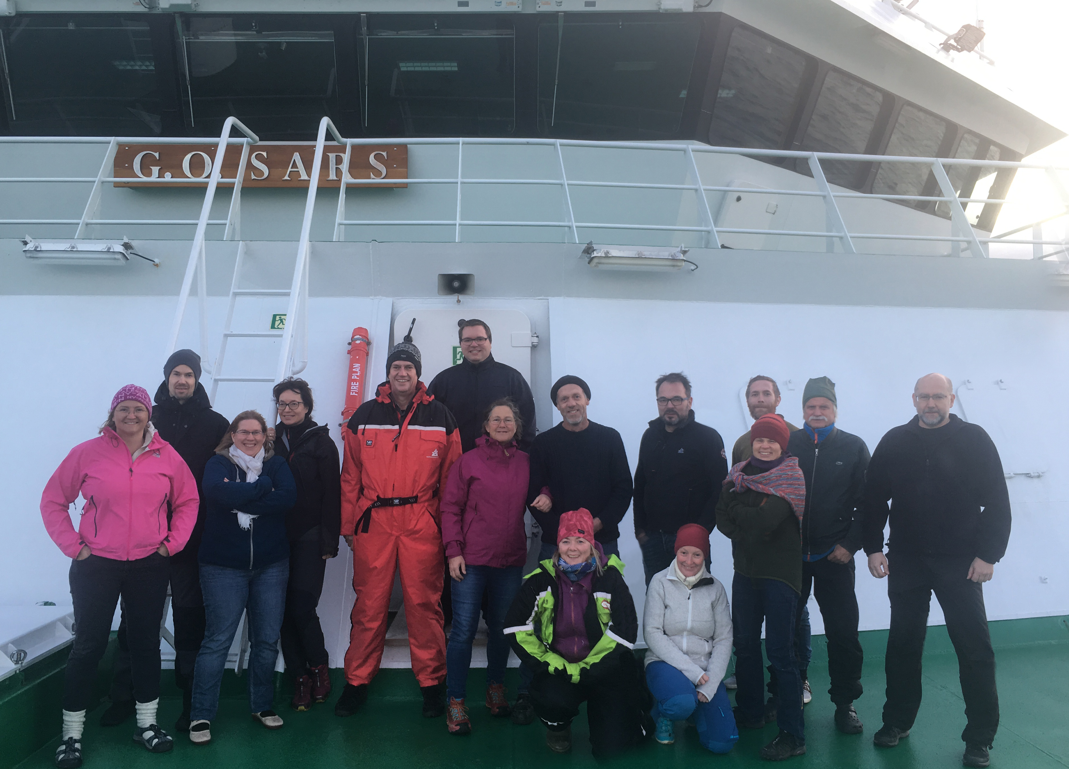
Leaving Tromsø in beautiful weather.
Leaving Tromsø in beautiful weather.
Published: 05.11.2019
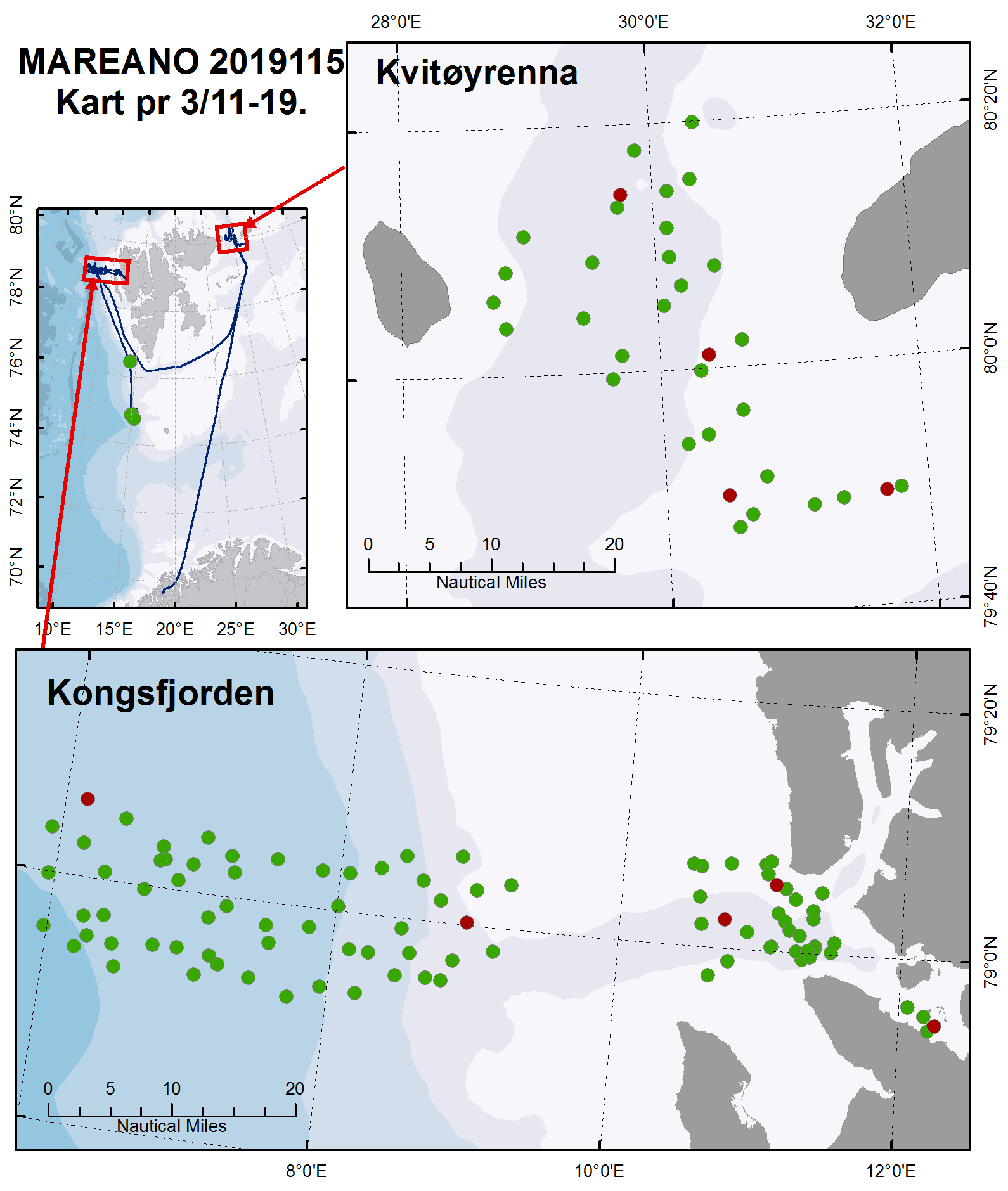
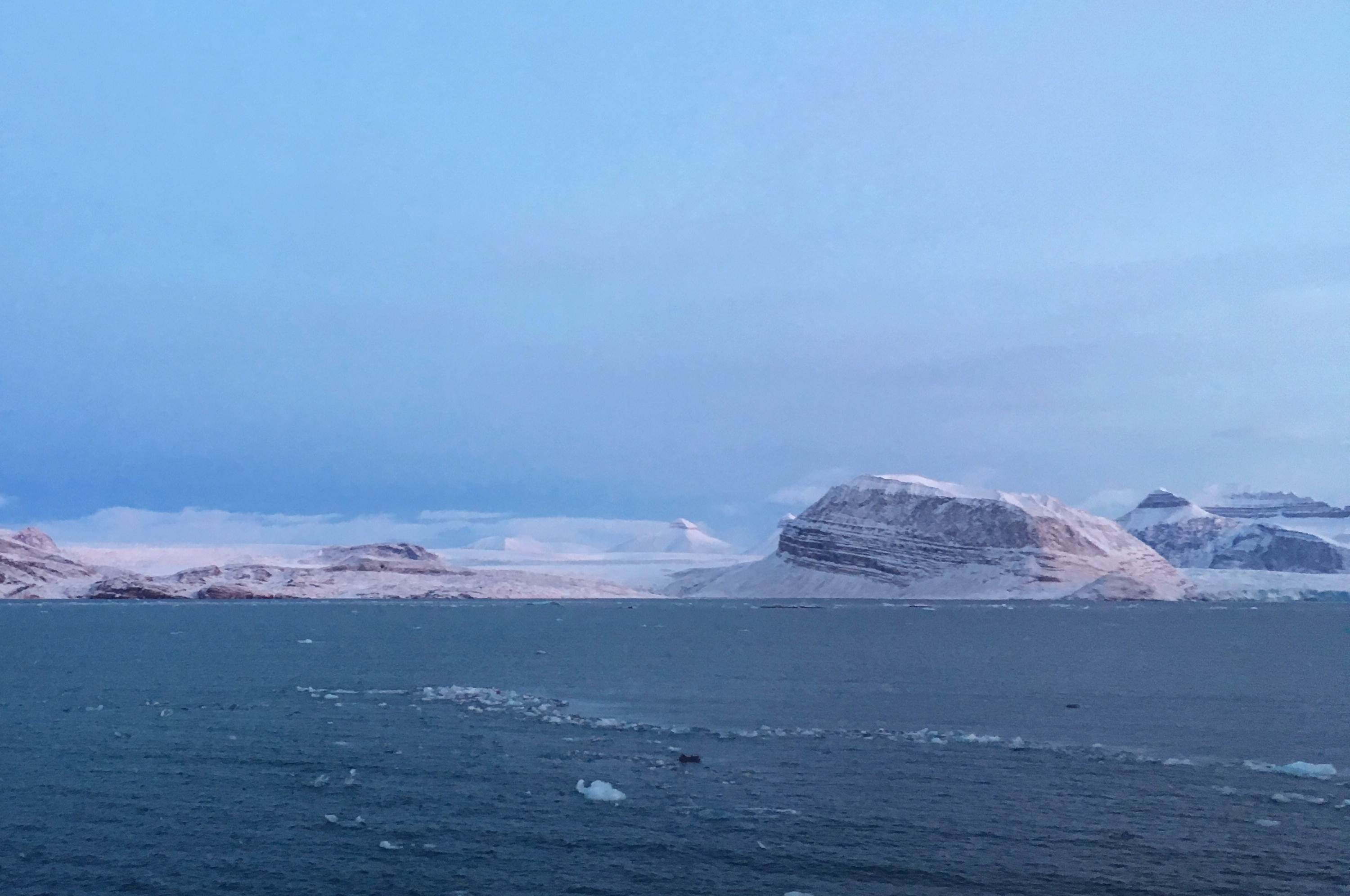
Kvitøya is the easternmost island of the Norwegian Kingdom, and part of the Svalbard archipelago. At the ice-free south-western tip of the island the remains of the Swedish expedition led by the engineer Salomon August Andrée were found in 1930, 33 years after they died in an attempt to reach the North pole in a hydrogen balloon. But that is different story. G.O. Sars is not here to investigate cultural history remains, but rather the seabed and more specifically the benthic fauna, substrate and contaminants.
MAREANO prioritises mapping this area for several reasons. The biological communities here are particularly exposed to climate change. This area can be described as the last frontier of the Atlantic water, and the temperature, salinity and currents here may easily (and rapidly) change under its influence. Acquiring the relevant background information about the environment and species compositions is therefore a matter of urgency, and critical for detecting and understanding changes early. Another important objective is to document vulnerable marine ecosystems in order to manage the fisheries in a sustainable way. As a result of climate change the distribution of fish resources is changing, and the fisheries want to follow their targeted species. This is especially relevant for the northern part of Kvitøyrenna.
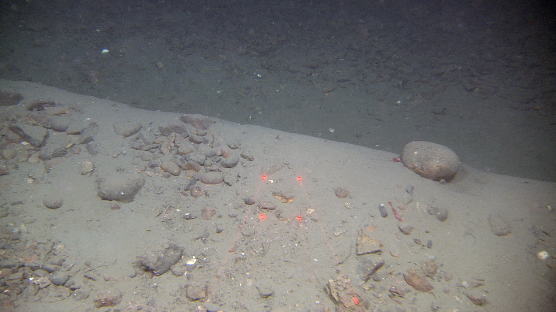
Kvitøyrenna (White Island Trough) is a submarine valley between Kvitøya and Storøya. The trough depth ranges between 200 m to 600 m, deepening towards both the north and south.
The seafloor consists of crystalline rugged bedrock in the north, while the southern area is dominated with smoother sedimentary rock with a variable cover of sediments. Large parts of this area are dominated by glacial landforms such as moraines, glacial lineations and iceberg ploughmarks.
The trough receives Atlantic water from the West Spitsbergen current, that follows the shelf edge west and north of Svalbard before entering the trough. Due to the funnel shape of the trough, strong currents can be expected in the shallowest parts. Under such conditions, interesting fauna communities with suspension feeders such as soft corals and seapens can be expected.
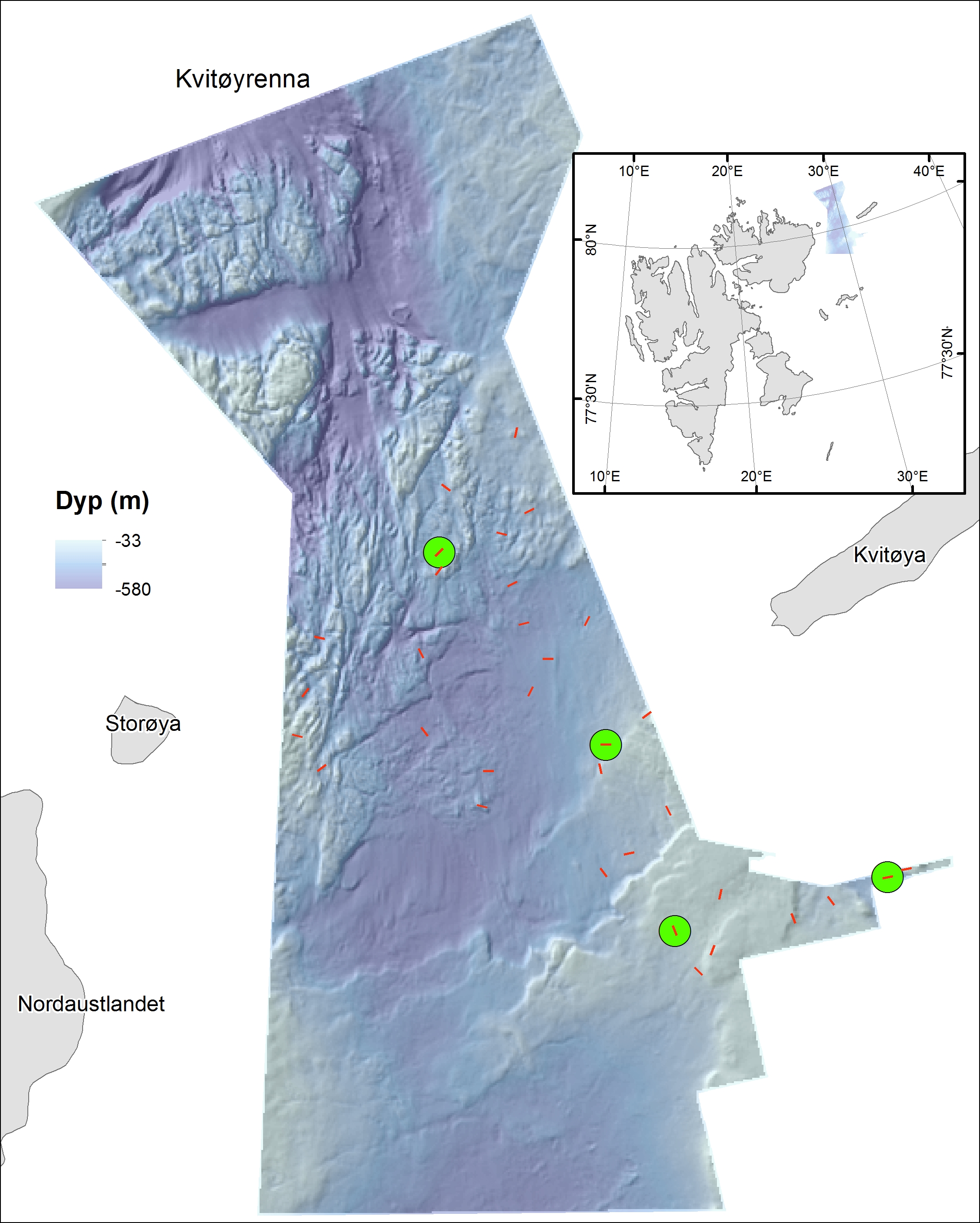
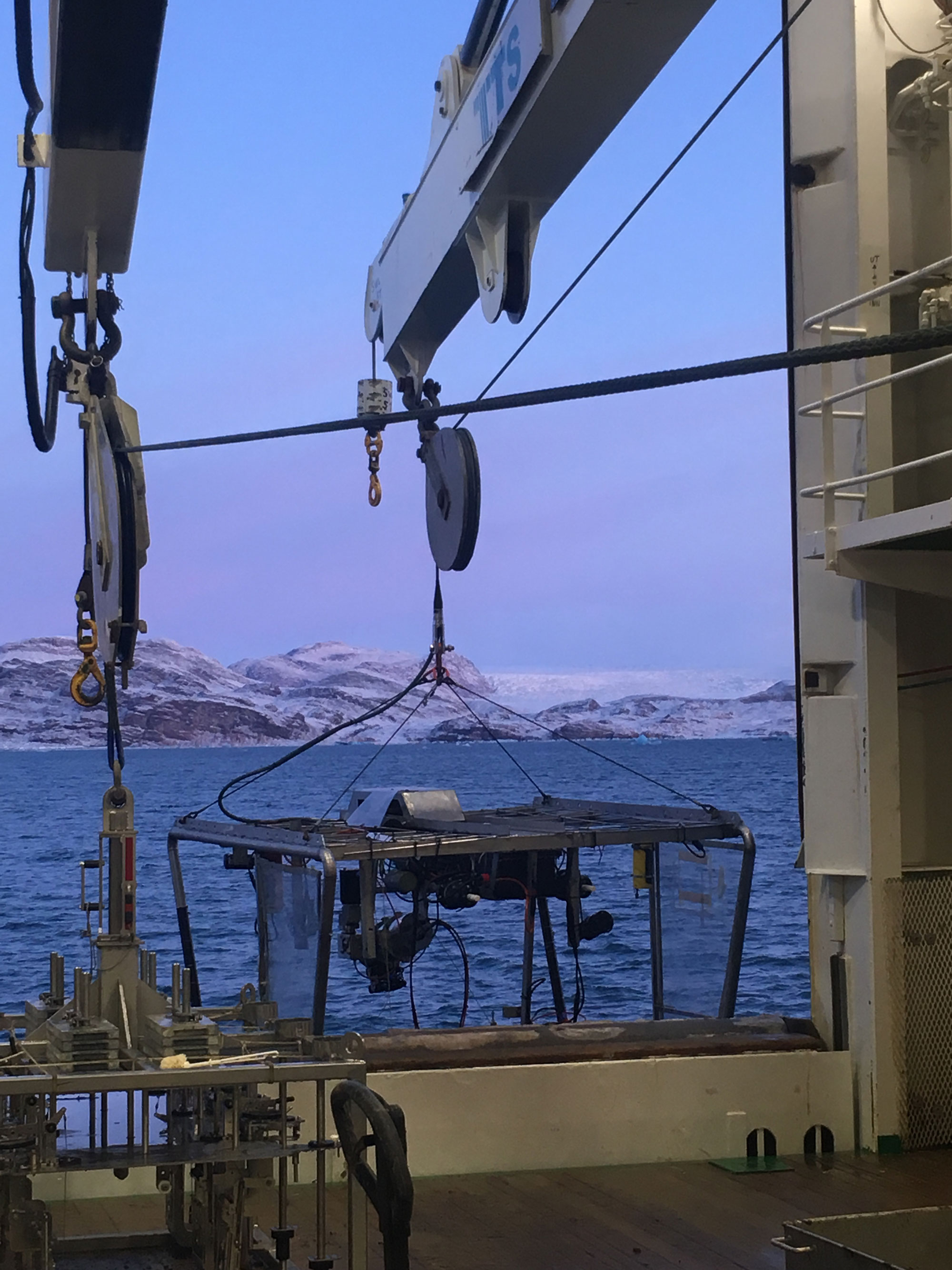
It was planned to investigate the seabed at 120 localities, distributed within different types of environments between 40 and 560 m depth. At ten of these additional seabed sampling was planned. In addition to sampling sediments and benthic organisms, samples were to be taken for analyses environmental DNA (eDNA), both in the water from near the seabed and in sediment samples taken with grab. eDNA analyses can provide information about which animals may occur in the surrounding environment. These results will later be compared with the results of the identified species in the sediment samples. In addition, sediment cores will be taken for analyses of various environmental contaminants, including the more “classic” ones like heavy metals, hydrocarbons, chlorinated and brominated pollutants and the so called “new contaminants” such as siloxanes (from cosmetics), fluor and phosphorus flame inhibitors, chlorinated paraffines and dechloranes. Samples will also be taken for detection of micro plastic.
We knew that the ice conditions might be a limiting factor this far north, at this time of the year. However, statistical maps of the general distribution of drifting ice, and real-time satellite surveillance indicated that the area should be accessible. Although, G.O. Sars is a modern ocean-going research vessel, it is not an ice breaker. When we arrived to Kvitøyrenna, the wind had turned, now blowing from the north and leading to a rapid drift of sea ice towards our destination. As a result, we were limited to working in the southern half of the planned mapping area.
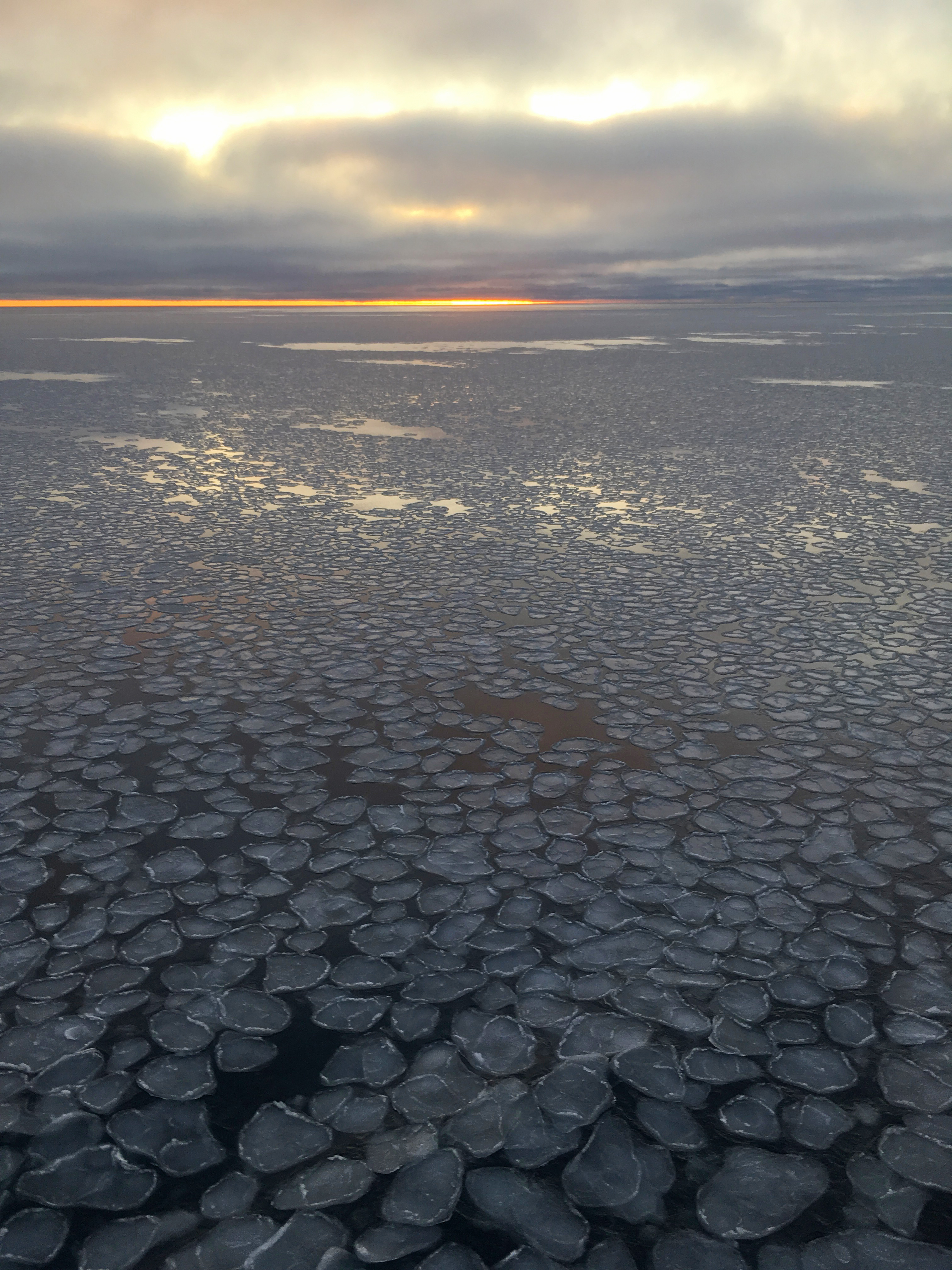
Unfortunately, the cruise was prevented from investigating the northern part of Kvitøyrenna because of all the ice. The ice drifted southward, day by day, and we were slowly «squeezed» out of the trough. When the weather forecast announced bad weather with storm and low temperatures (-15 °C), we knew we had to change our plans.
But before we continue; what did we find in Kvitøyrenna?
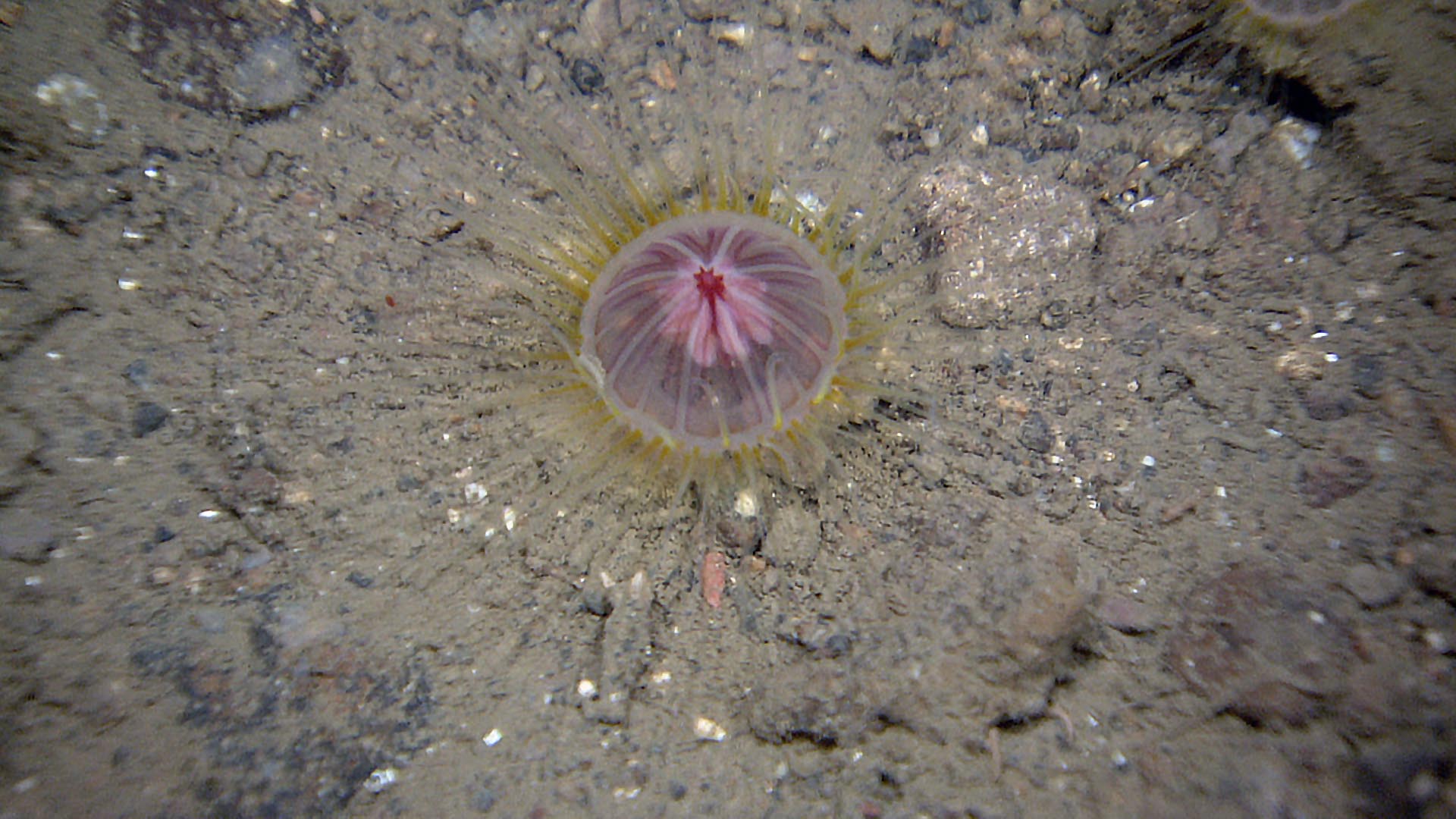
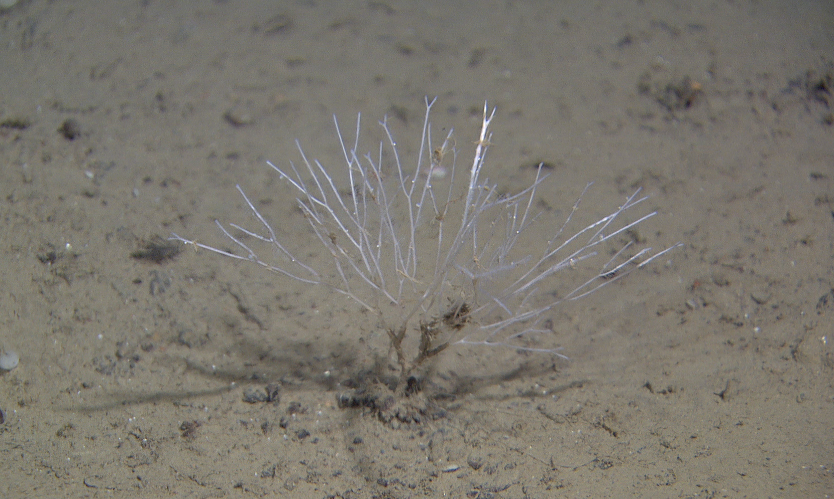
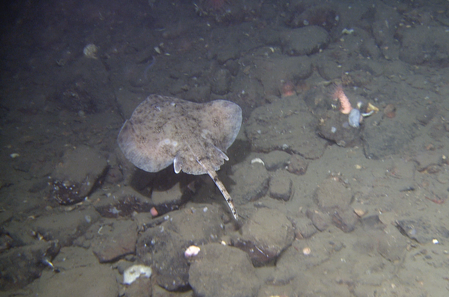
We seem to be in the sea of the featherstars (Crinoidea) and soft cauliflower corals (Nephtheidae). A community dominated by the crinoid Heliometra sp. and various cauliflower corals is not unique for Kvitøyrenna but is also found on the continental slope in the Norwegian Sea, at the Jan Mayen ridge and the British Isles (north of the Wyville Thomson Ridge. Not only the featherstars Heliometra glacialis, Hathrometra tenella and cauliflower corals of the genera Gersemia and Pseudodrifa, are examples of an Arctic fauna present in the deep Norwegian Sea, but also other peculiar animals as the bottom dwelling jellyfish Ptychogastria polaris, the starfish Urasterias lincki and the tube anemone Cerianthus vogti are species typical for this area.
There are sharp gradients in temperature and salinity in Kvitøyrenna, both from north to south and from shallow to deep. The influence of Atlantic Water is greatest in the northern part with bottom temperatures around 1,5 °C. In the southern part supply of Arctic water from east provides temperatures around -1,25 °C.
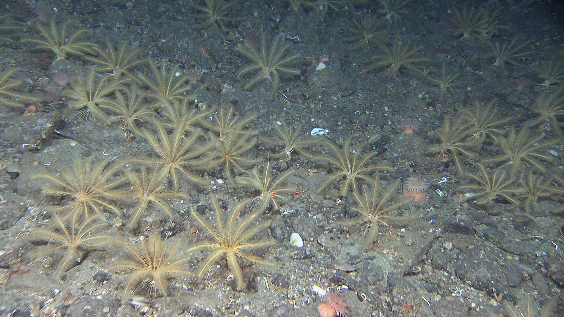
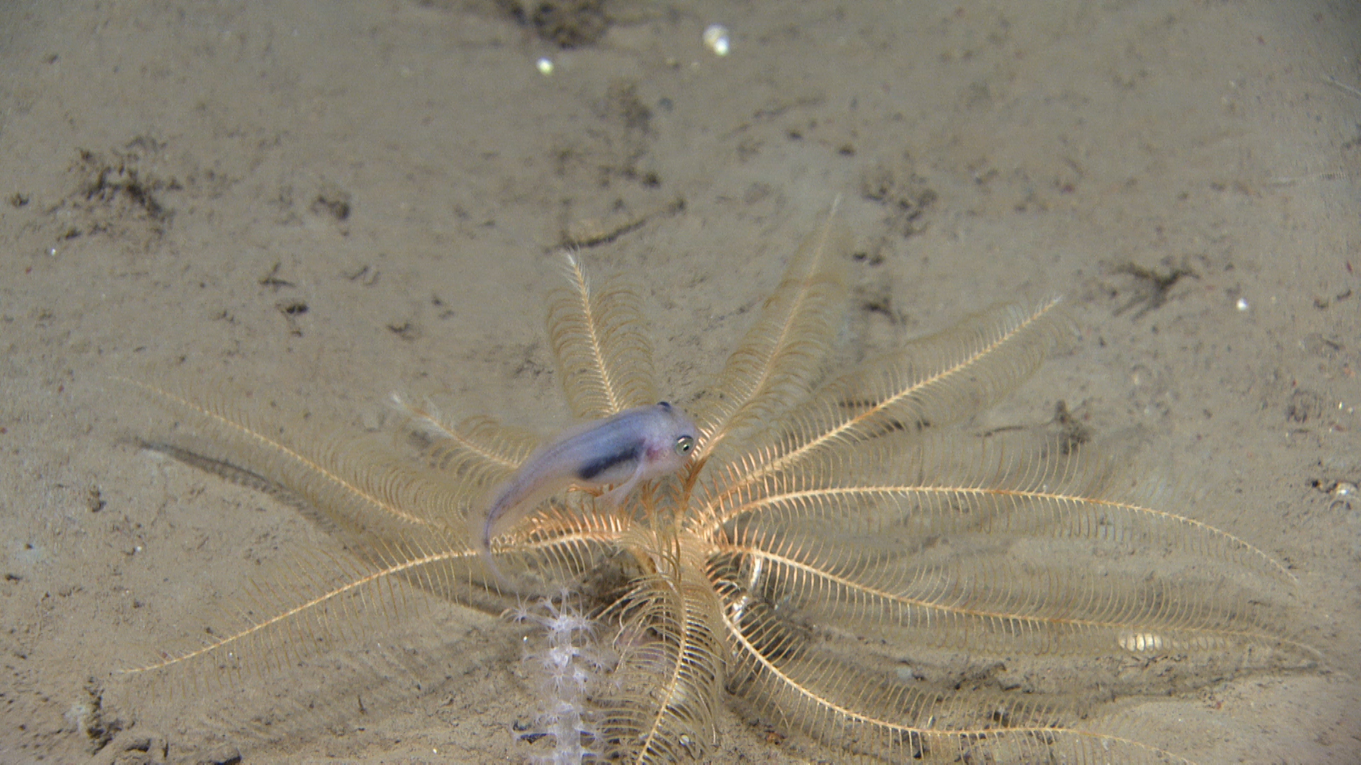
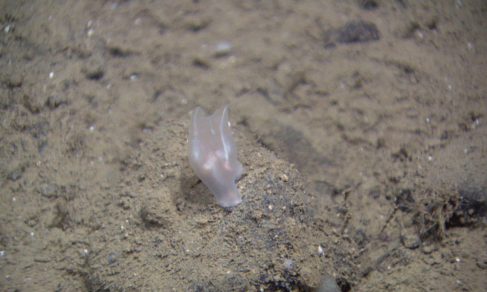
We observed dense stands with feather stars many places. From samples with beamtrawl we identified two species, Hathrometra sp. and Heliometra glacialis. The latter of these were clearly the most common and abundant. Several times, we have observed small snailfishes between the arms of the Heliometra. We don’t know what it is doing there. Maybe it is resting, finding food, or maybe it is safer there than out on the open gravelly seabed?
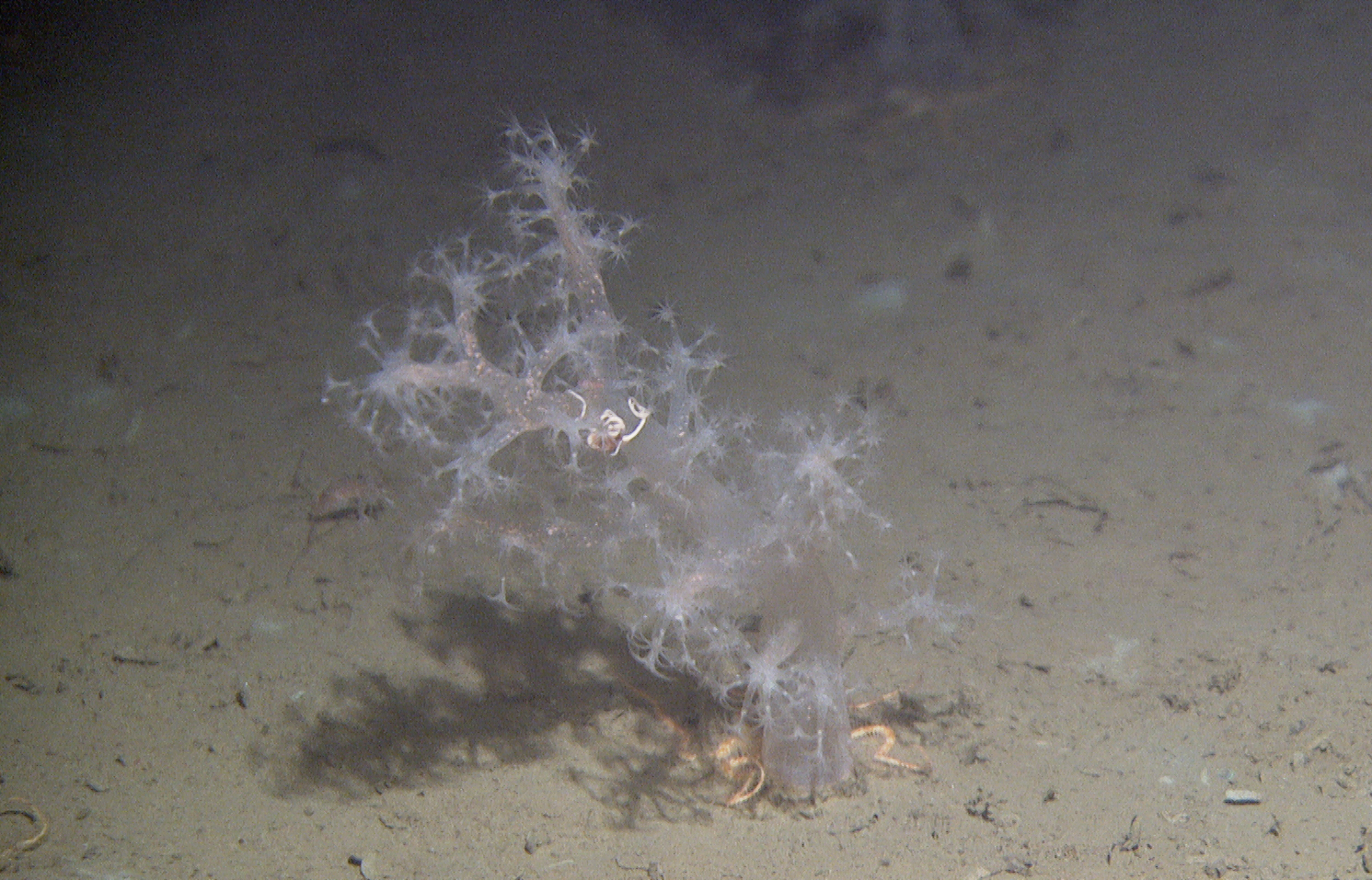
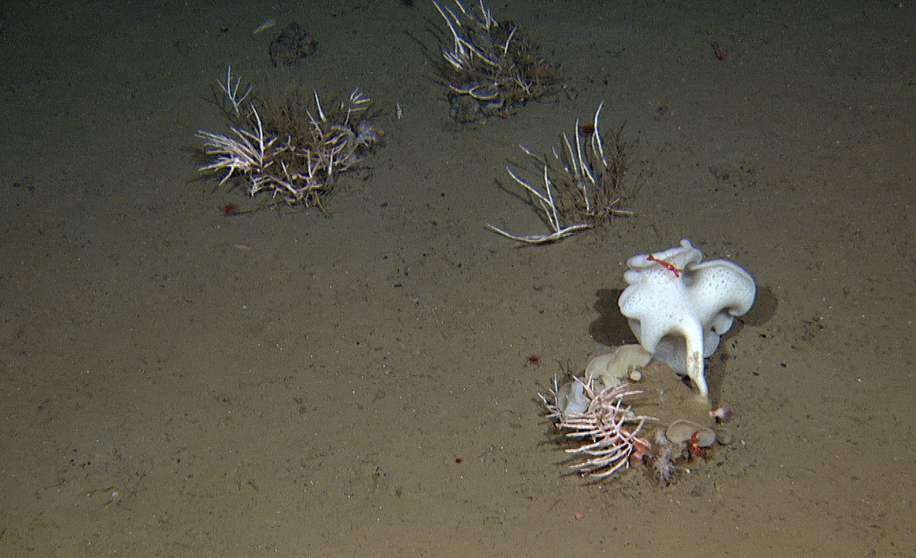
Some places the soft cauliflower corals formed miniature forests, like trees on a savanna. There are at least two species within the genera Gersemia and Pseudodrifa. These cauliflower corals are important for the basket stars (Gorgonocephalus sp.), a type of brittlestars with branched arms. They often carry juvenile stars clinging on to the branches. This is where these stars grow up.
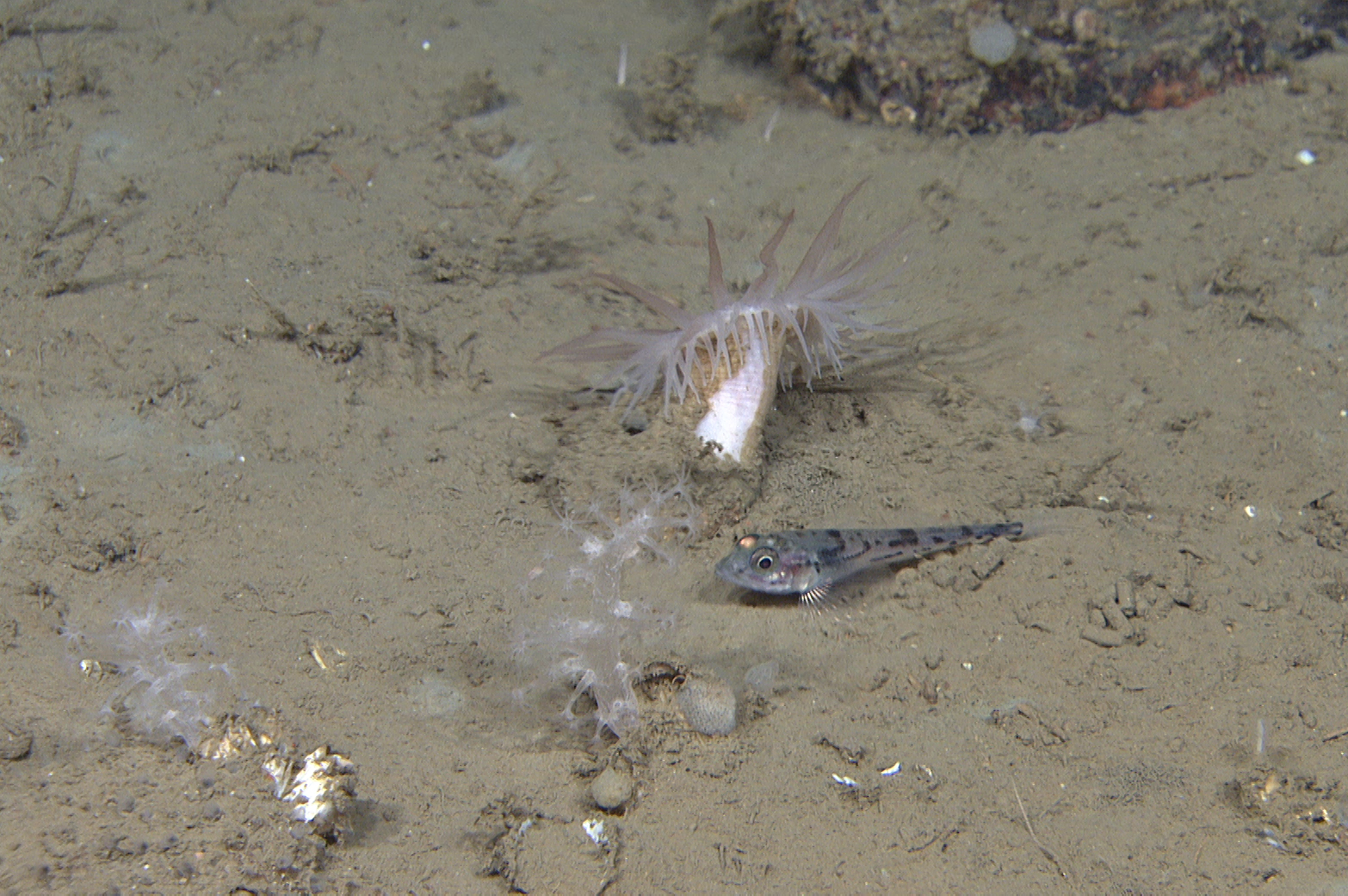
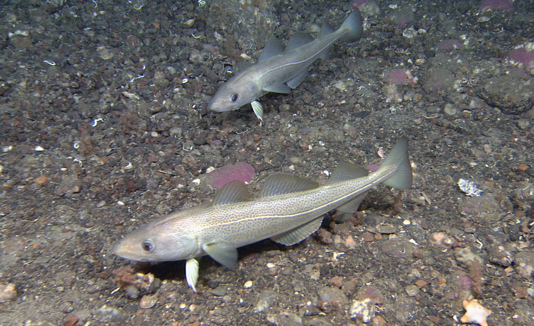
The absence of large fishes was striking in the southern part of Kvitøyrenna, during this cruise. The fishes we observed were small, such as different snailfishes and ribbed sculpin.
Due to increasing wind from the north and the rapidly increasing cover of drifting ice, G.O. Sars had to «flee» from Kvitøyrenna, and move to a back-up area on the west side of Svalbard. Luckily, this area stayed clear of both ice and wind.
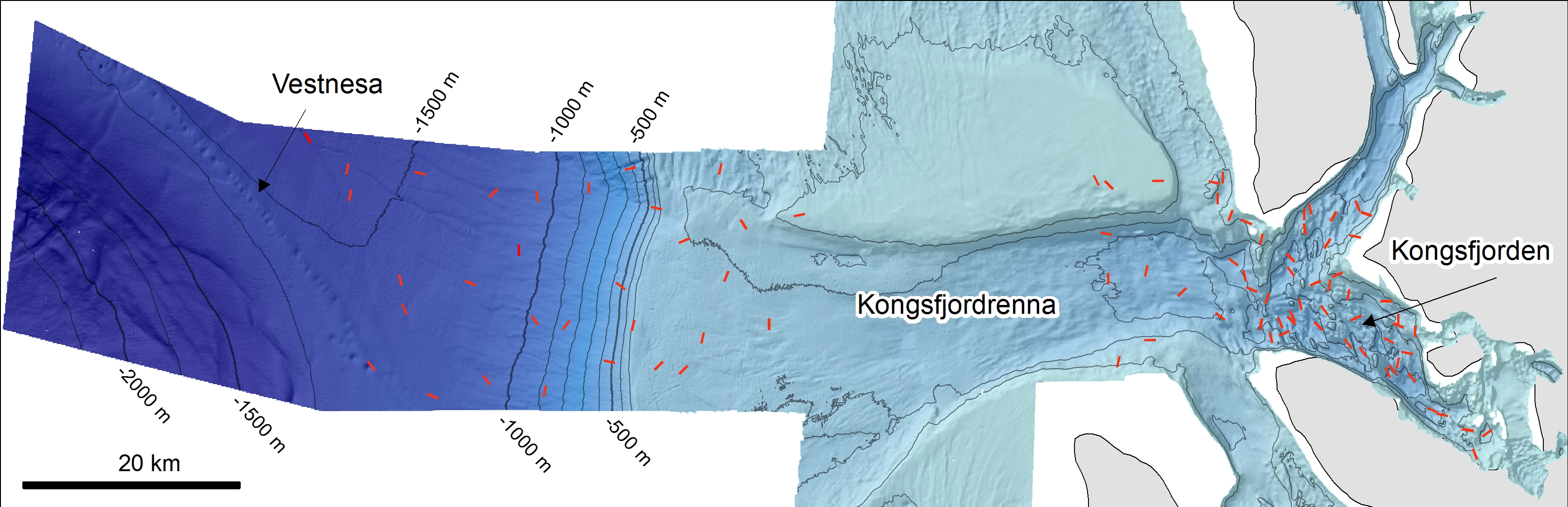
This new area included the so-called Kongsfjorden transect, covering diverse fjord, shelf and slope environments, in Kongsfjorden, Kongsfjordrenna trough and Kongsfjordvifta trough mouth fan respectively. A part of the fjord was sampled last year (see previous cruise news), and our task now was to complete the sample acquisition, including both visual and physical sampling. The survey locations spanned a great environmental gradient from the innermost, relatively shallow and glacially influenced seabed environments, to more exposed locations on the continental shelf and near the coast, as well as to the deep sea just below 2000 m depth.
The seabed in Kongsfjorden displays great variation in depth and substrate type. The seabed terrain is characterized by shallow sills and bedrock outcrops, and deeper basins filled with cinnamon coloured soft mud. The fjord has a mixture of Arctic and Atlantic water but is also strongly influenced by several glaciers calving into the fjord.
Meltwater draining from the glaciers is an important source of freshwater and sediments in the fjord environment. The sediments are carried in suspension far out in the fjord, before the particles settle at the bottom. In addition, icebergs breaking off the glacier snouts can carry larger clasts far out in the fjord, before they melt, and the clasts are dropped to the seabed (dropstones).
The survey stations in the innermost part of the fjord were inaccessible for G. O. Sars because of all the icebergs. The seabed in the inner basin is very soft and the animal life rather scarce, only with shrimps, long rough dab, pricklebacks, sea anemones and a few Gersemia-cauliflower corals. On the edges of the deep trench there is more gravel. Sedimentation from the glaciers is evident all the way to the mouth of the fjord.
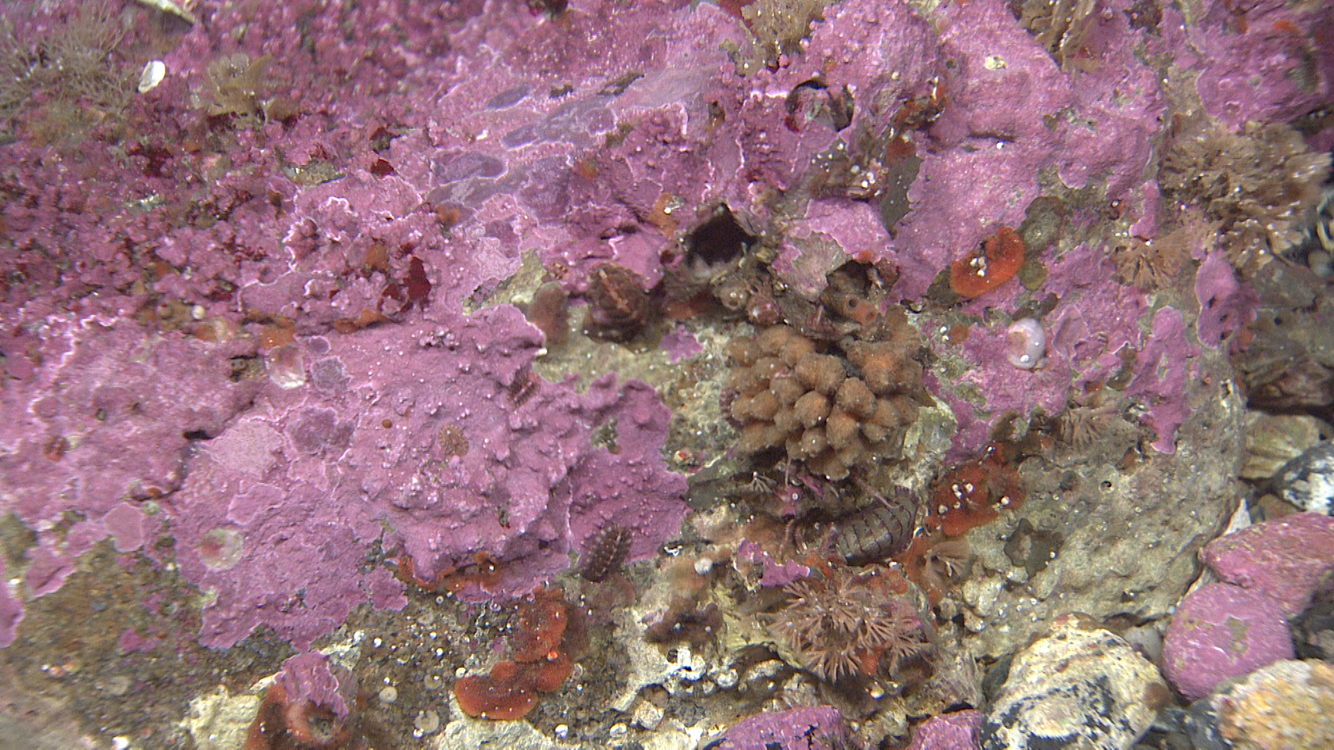
The shallowest locations that we investigated, at around 40 m depth were exposed to the open ocean, and just below the range of seaweeds and kelp. The vivid colour and the associated biodiversity is a great contrast to the more or less monochromatic grey-brown seabed deeper down. The purple colour of the seabed is made by the calcareous red algae Lithothamnion sp. Some of these species form so-called mearl beds elsewhere in the North Atlantic.
Within the territorial boundary (12 nautical miles from land), special permit is needed for sampling the seabed. Outside this border, on the other hand, it is difficult to find a place without traces of bottom trawling. Among overturned rocks covered with sand and mud we find lots of broken shells and a poor fauna, but shrimps are numerous.
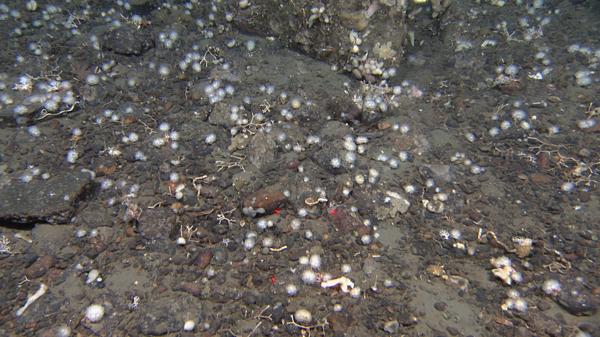
Farther out, beyond the continental shelf break we meet the deep-sea fauna of the West Barents Sea, quite similar to what we previously have seen in the Norwegian Sea west of Lofoten and west of Bjørnøya. In Kvitøyrenna we found several of these species at much shallower depths (see previous new stories in Norwegian). We recognize the carnivorous sponges different glass sponges and many other remarkable species.
At the continental slope around 1000 m depth we often find a small (ca 1,5 cm) benthic ctenophore (comb jellyfish). We have seen the same animal at many MAREANO cruises covering deep and cold water. Similar organisms have been observed by other expeditions around the world, however, it still remains to be identified, and we may conclude it is a new species. So, if you are or know of anyone out there who is an expert on Ctenophora, please get in touch with us. We have many pictures of it from all angles, but sadly, no sample at this point.
In total, during this cruise we have filmed 129 localities around Svalbard. At 9 of these samples were also taken.