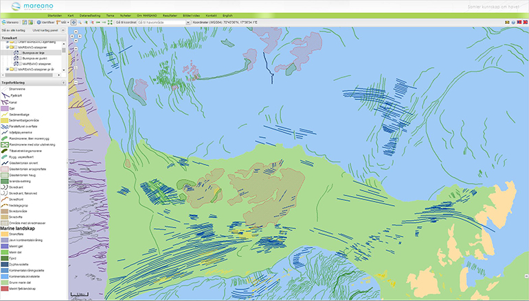
Goto main content

Marine landforms

A wide variety of landforms made by geological process are found on the sea bottom. The landforms tell us how the seabed is formed, and what sedimentation processes are active today.

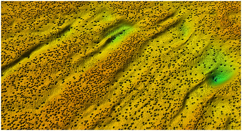
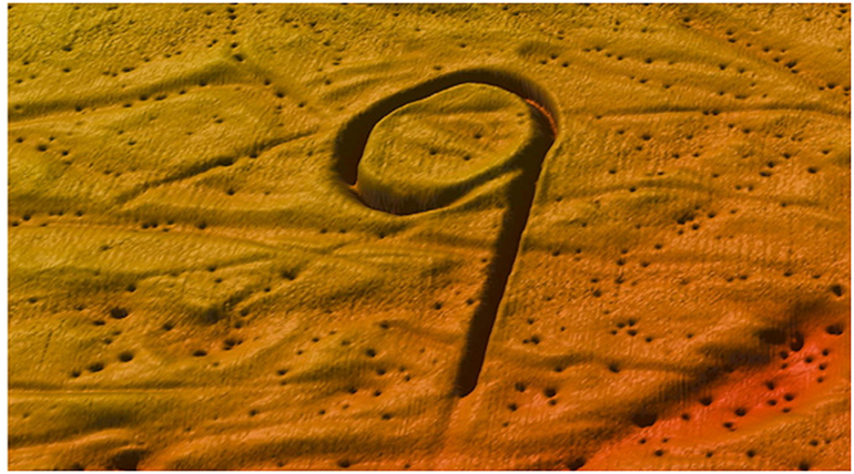
The age of the marine landforms can vary from just a few years to several million years. Similarly, the size of the land forms can vary immensely. On the continental slope, we find the giant submarine landslides that date anywhere between a few thousand years to several hundred thousand years old. Examples of seabed landforms mapped by MAREANO are channels, canyons, sediment waves, areas with sediment waves, glacial lineations, iceberg plough marks, moraines, slide escarpments, slide scars,  slide areas, areas with slide deposits, submarine fans and areas with pockmarks.

Locating these landforms is important for activities related to construction on the sea bottom, fisheries, aquaculture, oil and gas exploration, and environmental monitoring.  Detailed mapping of marine landforms is an important task for MAREANO.

model
Bathymetric data from MAREANO show ridges and depressions (green=deepest, orange=shallowest ) in the seabed of the Barents Sea. Thousands of pockmarks, shown as dark dots, are seabed craters formed where gas or liquid has leaked from deeper layers through the seabed surface. The pockmarks are 50-100 m wide.


model showing marks on seabottom
Here are shown ploughmarks from drifting icebergs that scraped along the bottom in the Barents Sea. The "9" is ca. 1000 m long and 5-6 m deep ploughmark which was formed at the end of the last ice age 10 000-15 000 years ago. The numerous small craters are pockmarks which in this area reach ca. 50 m in diameter and a few meters depth.


screenshot from map service
Marine landforms on a background of marine landscapes. The large green area represents the Håkjerringsdjupet glacial trough outside Troms.


Contact

Photo of Frank Jakobsen

Frank Jakobsen

Geological Survey of Norway
Geologist/Researcher
Photo of Lilja Rún Bjarnadóttir

Lilja Rún Bjarnadóttir

Geological Survey of Norway
Geological mapping
Geologist
944 97 728