Goto main content

News

Result: (157) Showing 151 - 157

m bilde 2b settes sammen 2a

News and pictures from the MAREANO summer cruise 2010

09.08.2010

A quick note from all on board the Norwegian research vessel ‘G.O. Sars’. We are making good progress with the first of two MAREANO cruises to be undertaken this year, and are now mid-way through the second and final leg of this research cruise.

Eggakanten FieldNT english stort

A general nature-type map for Eggakanten

08.03.2010

Mapping the distribution of seabed nature types is an important component of MAREANO. Nature types follow, and contribute to the development of the Norwegian Nature Types classification scheme at the nature-system level.

page thumb 9151

2700 metres below sea level

24.11.2009
Blue holothurians (sea cucumbers) amongst sea lilies together with brilliantly red shrimps and irregular sea urchins were just some of the astonishing creatures that scientists observed when they earlier this autumn they explored the sea bottom down to 2700 metres depths in Nordland VII, an area off the coast of Northern Norway.
medusahode 500

Investigating the Norwegian continental shelf and deep slopes in the arctic

07.10.2009

R/V G.O. Sars left Tromsø harbour 18 September with steady course heading for the “Eggakanten”, the continental shelf break northwest off the Norwegian mainland, approximately half-way to the Bear Island. The mission was to map the seabed as part of the Norwegian mapping programme MAREANO. The cruise is divided in two legs; the first, which we report from here, was undertaken between 18 and 30 September and the second leg which runs from 30 September until 11 October. Onboard were 14 scientists and technicians within the fields of marine taxonomy, geology and chemistry.

page thumb 9120

New articles from MAREANO

19.08.2009

In the beginning of August (2009) the Norwegian Journal of Geology published a thematic issue with 15 new articles mainly based on results from MAREANO.

page thumb 9040

The April 2009 MAREANO cruise

22.04.2009

Scientists from the Institute of Marine Research (IMR) and the Geological Survey of Norway (NGU) have started the April 2009 MAREANO cruise (2009105) aboard the "G.O. Sars". The scientific crew includes Norwegians, French, Danish, Canadian, German, Faroese and Finnish. The northernmost study area is located on the continental shelf, approximately 195 nm north of the Norway coast. The 9000 km2 large study area, covered by the cruise, includes depths ranging from 300 to 1000 meters, and will be mapped for benthic fauna, bottom types and environmental status.

page thumb 8675

Biodiversity at great depths

13.06.2008
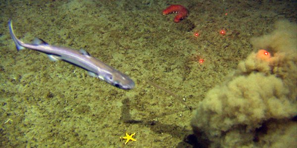
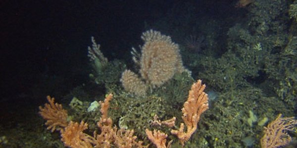
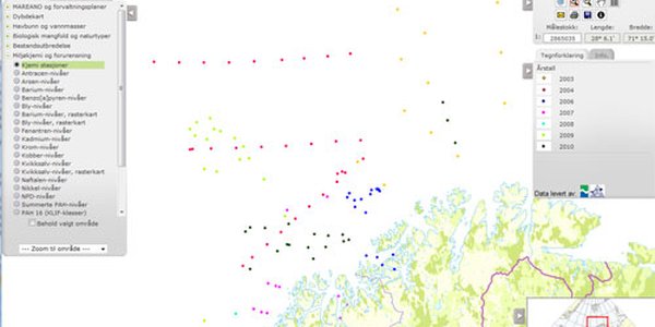
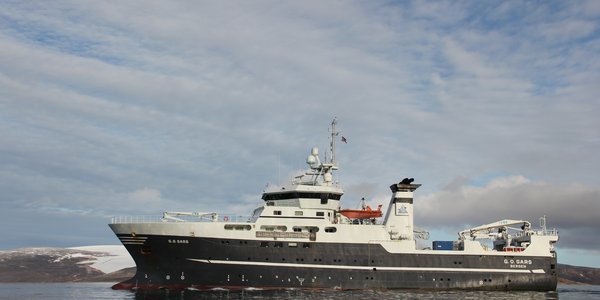
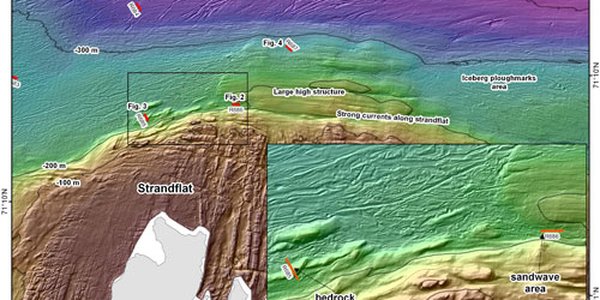
The Norwegian seabed mapping programme, MAREANO, has just finished its fourth cruise off northern Norway with the research vessel G.O. Sars. The target of this cruise is deeper slope areas off the counties of Troms and Nordland. The investigation covers several very different marine landscapes including submarine canyons, coral reefs, moraines, sand dunes and consolidated clay with rough topography.