Contact
Biological mapping
Børge Holte
+47 77 60 97 53
Geological mapping
Terje Thorsnes
+47 73 90 42 75
Bathymetry
Hanne Hodnesdal
+47 51 85 88 23
Information officer
Beate Hoddevik Sunnset
+47 55 23 85 16
Published: 18.09.2012 Updated: 03.10.2022
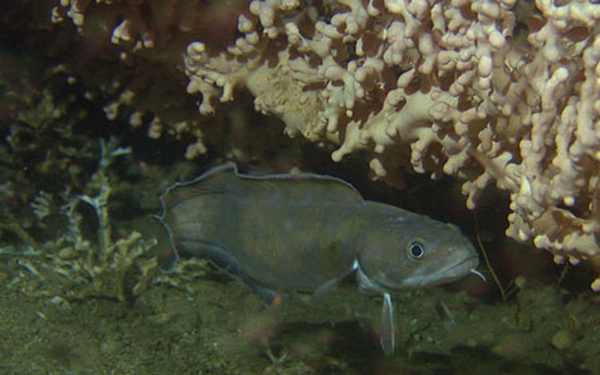
- The reef complex at Sula consists of 500 individual reefs up to 1 kilometer long and 35 feet in height. Substantial influx of nutrient-rich Atlantic water onto the ridge at Sula means that these coral reefs have an abundant supply of food. The reef at Sula is home to the second largest complex of cold-water corals discovered in the world; the largest complex was discovered just north of Røst Island, says cruise coordinator, Pål Buhl-Mortensen.
All MAREANO cruises are equipped with the Campod custom-built video rig. Researchers expect that these video recordings will provide improved photo documentation of benthic habitat and organisms.
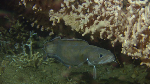
The survey does not focus exclusively on corals; researchers also investigate the condition of areas where corals are likely to occur, and conducts through mapping of these areas.
- Previous surveys have been focused on corals. As consequence, we have little knowledge of benthic areas where corals do not occur. Benthic areas off the coast of mid-Norway are rich in sea life and have high fish productivity. During this cruise, we expect to find several new reefs, in addition to the area with gas-seep communities and sponge beds, says Buhl-Mortensen.
It's not just special bottom types and vulnerable habitats that researchers are looking for while mapping the benthos during MAREANO surveys.
- One of the major goals for MAREANO is to map benthic habitats, including areas which appear drab and boring, muddy and gray, or sandy and lifeless. In areas such as these we can make exciting new discoveries. In such benthic habitats, animals live burried within the sediments. Only through close investigation it is possible to uncover and describe the wealth of small organisms inhabiting them, says Buhl-Mortensen.
Altogether, samples from an area of 6590 km2 are collected when the cruise is finished the second week of October. Initially, the Iverrigde, the reef complex at Sula, and parts of the Møre banks will be surveyed using the Campod video rig. Survey results describing these areas must be completed by September 2013 to support scheduled revision of the plan for Integrated Management of the Norwegian Sea. During the latter part of the survey, outer regions of the Møre banks will be investigated using various bottom-sampling techniques.
If you are interested to learn what scientists aboard "R/V G.O. Sars" discover during the 2012 Fall Survey, you can follow the cruise reports which are to be published on www.mareano.no.
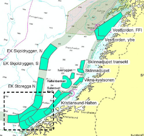
Areas to be examined during the 2012 fall survey.