
Nicolien Haasbroek
Norwegian Mapping Authority, Hydrographic Service
Bathymetry, procurements
Project Engineer
+47 51 85 87 13 / +47 418 56 917
Published: 10.04.2024
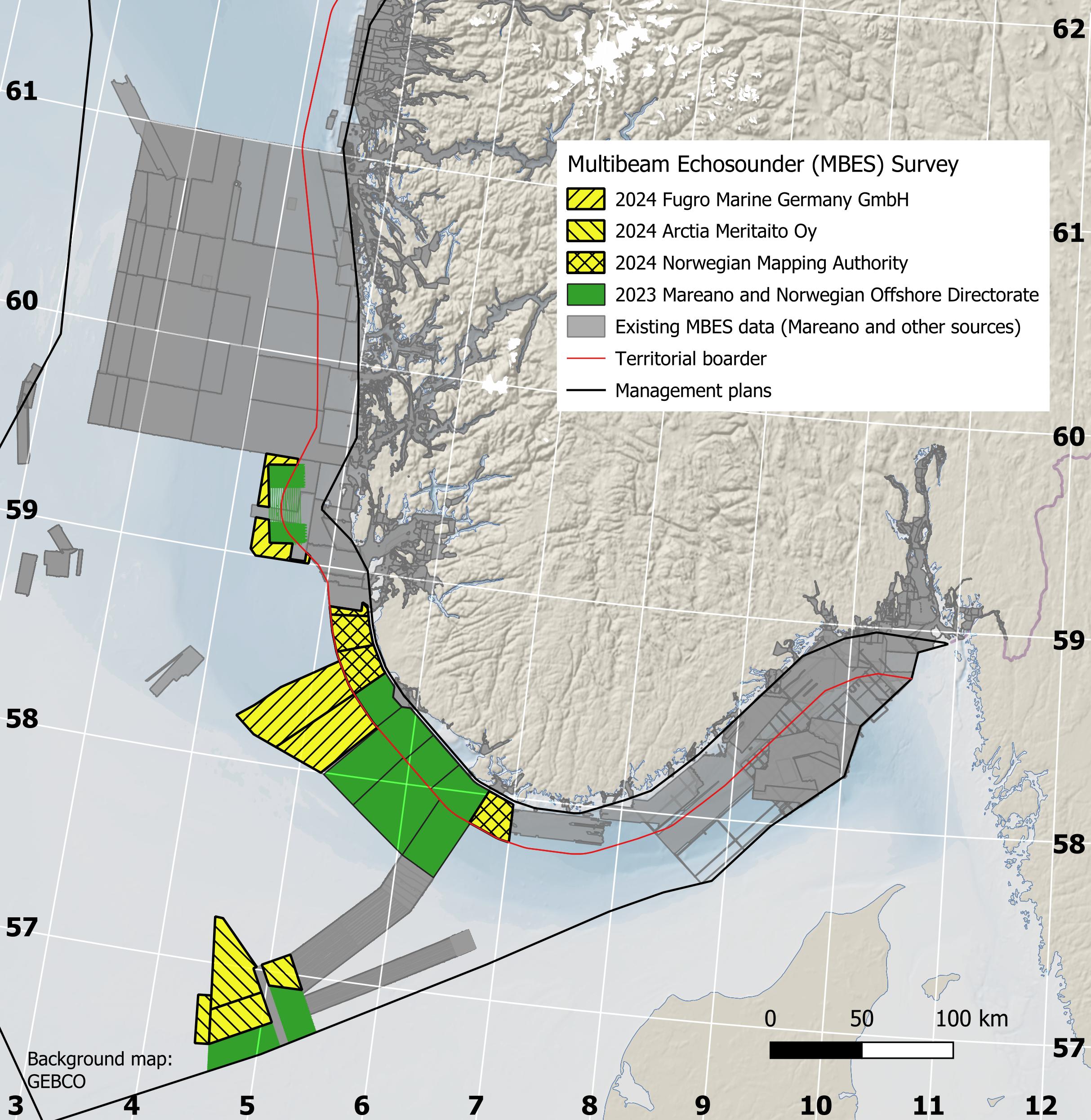
The last few years, the MAREANO programme has placed emphasis on the North Sea. There is a need for marine knowledge linked to the new marine industries – such as offshore wind and offshore aquaculture – and the particularly valuable and vulnerable areas (SVO).
The assigned contractors are Fugro Germany Marine GmbH for the deep-sea areas in the North Sea and Arctia Meritaito Oy for the shallower waters in the Norwegian Trench. The open invitation to tender for the procurement of bathymetry data acquisition, processing and light seismic, was published December 2023.
The two contracts comprise:
I addition, MS «Hydrograf» will survey an area of 1290 km2 inside the territorial boarder in the Norwegian Trench. MS «Hydrograf» is owned by the Norwegian Mapping Authority, Hydrographic Service.
The areas “Sørvest F” and “Vestavind F” are a continuation of the mapping conducted by the Norwegian Offshore Directorate in the in the opened offshore wind areas “Sørlege Nordsjø II” and “Utsira Nord”. “Sørvest F” and “Vestavind F” are undergoing a strategic impact assessment, with the aim of opening and announcing project areas within these areas in 2025.
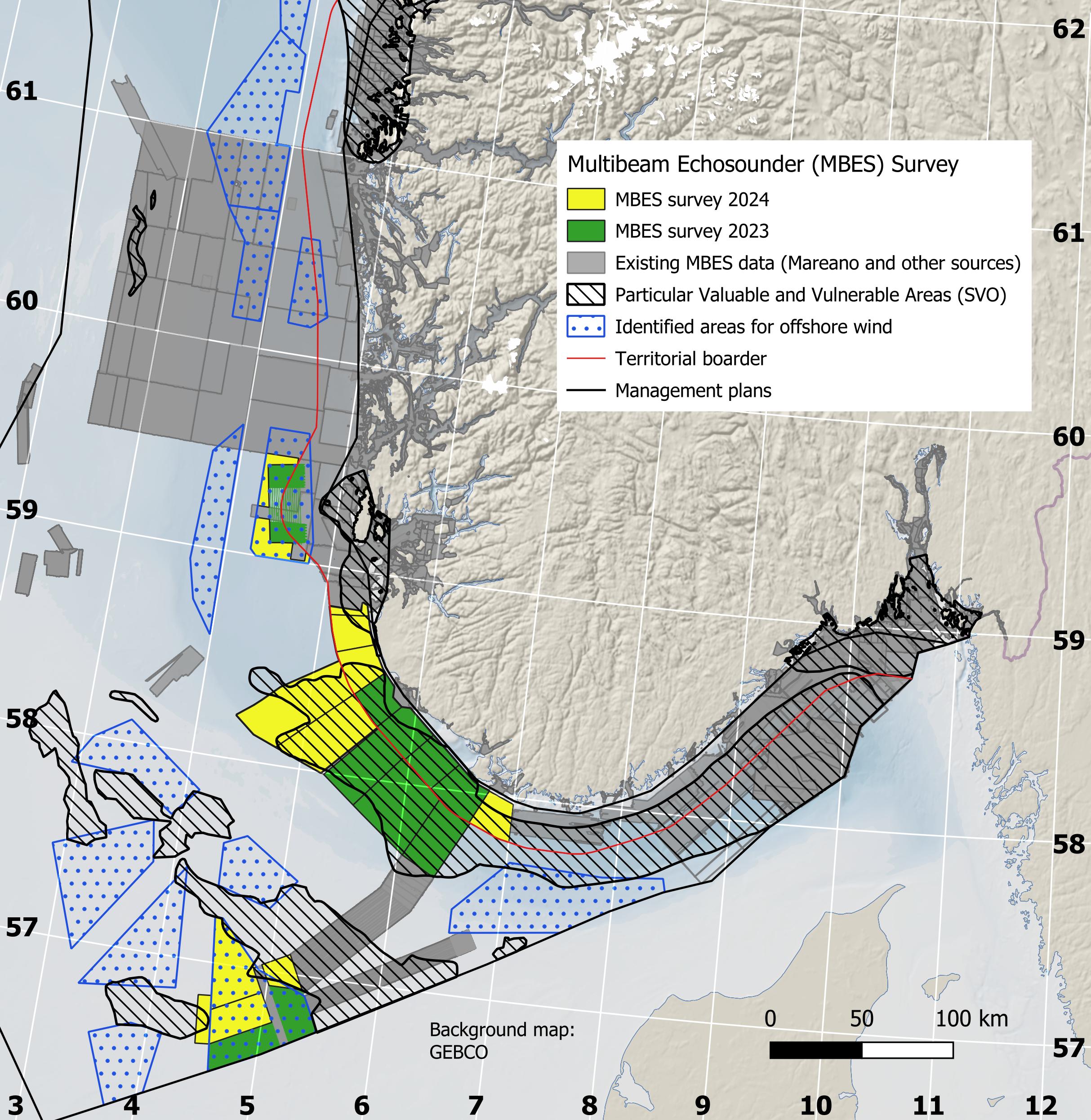
Data from the offshore wind areas surveyed by the Norwegian Offshore Directorate, will be published when the Norwegian Mapping Authority, Hydrographic Service gets access. The MAREANO programme will build on the bathymetric data sets to map the sediment composition, biodiversity, habitats and biotopes and pollution in the seabed. These surveys will be conducted by the Norwegian Institute of Marine Research and the Geological Survey of Norway.