Hanne Hodnesdal
Norwegian Mapping Authority, Hydrographic Service
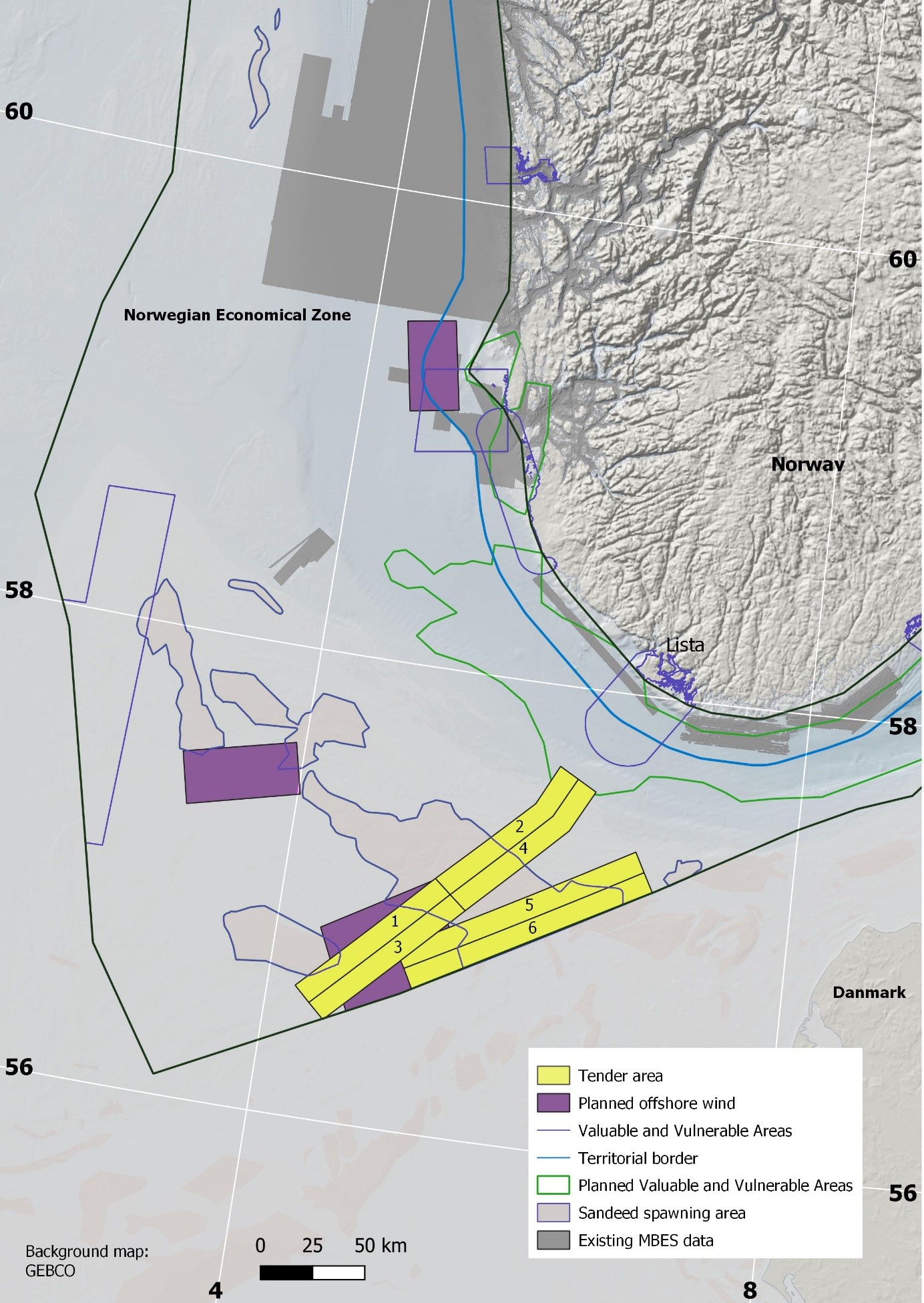
Bathymetry
+47 51 85 88 23 / +47 47 31 72 22
Published: 21.01.2022 Updated: 26.10.2022
The tender for bathymetric mapping comprises an area of 6000 km2 in the southern parts of the North Sea.
The open invitation to tender for the procurement of Bathymetry data acquisition and processing for the MAREANO programme is published on Doffin and TED:
The contract has a value of 10 million NOK, with the possibility of options. February 17 2022 is the deadline for submitting tenders.