2014
In 2014 the bathymtric mapping is to be carried out in two main areas: The Norwegian Sea and in the new Norwegian territory close to the Russian border in the Barents Sea. As shown in the figure below, the bathymetric mapping in the Norwegian Sea will take place at Haltenbanken, Sklinnabanken, Sklinnadjupet and Stadhavet. These bathymetric multibeam measurements are always carried out before the biological, geological and chemical sampling. This latter mentioned sampling is based on bathymetric information from which the sampling stations are located after studying terrain and backscatter data.
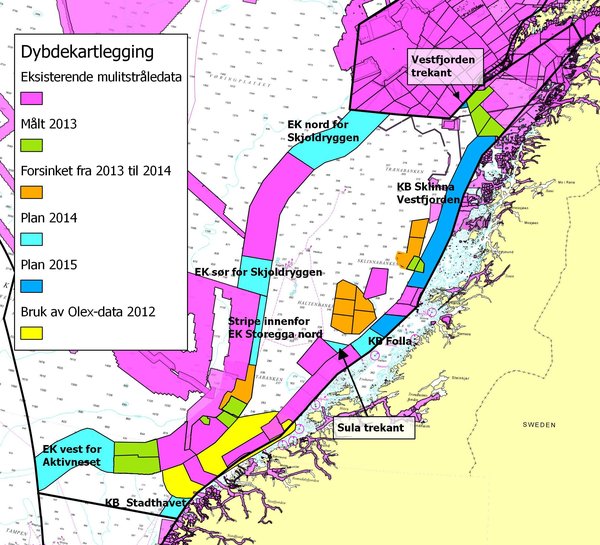
Areas where from multibeam bathymetric data is collected. Planned mapping in 2014 is shown in orange and light blue colors.
Three criuses were arranged in 2014. The figure below shows the surveyed areas that include the open sea off the coast of Finnmark County in the Barents Sea, in the new Norwegian territory along the Russian border in the Barents Sea, and North-East of the Mørebankene off the cost of South-West Norway. In total, an area of 16 315 km2 was sampled in 2014.
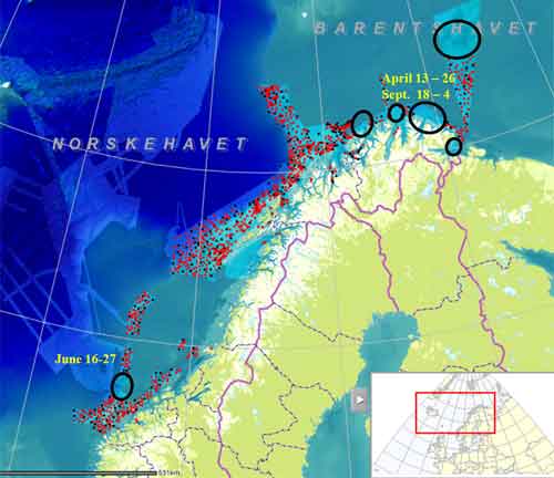
Areas sampled with regard to geology, biology and chemistry in 2014 (black circles).Earlier samples are shown as black and red dots. Black dots show positions sampled by all MAREANO gears (video, boxcorer, multicorer, sled, beamtrawl, grab),while red dots show positions where video-data solely has been collected.
During 2014 samples collected in 2013 and 2012 were be prepared in the laboratory, forming the background data for further preparation and modeling of batahymtric maps, geological maps showing information as e.g. bottom type/substrate, and biological and chemical results. Those maps are available at MAREANO's website.