Contact
Biological mapping
Børge Holte
+47 77 60 97 53
Geological mapping
Terje Thorsnes
+47 73 90 42 75
Bathymetry
Hanne Hodnesdal
+47 51 85 88 23
Information officer
Beate Hoddevik Sunnset
+47 55 23 85 16
Published: 12.06.2012 Updated: 25.07.2022
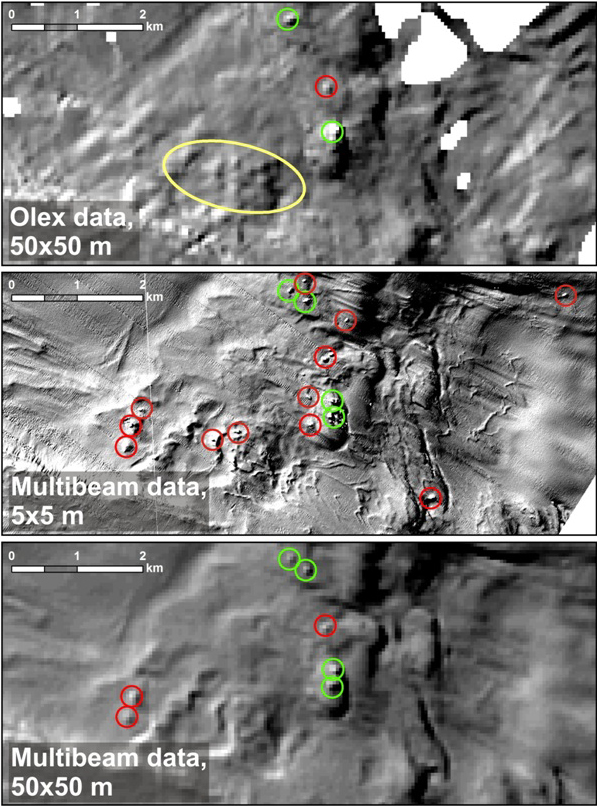
Good bathymetry data are essential for the MAREANO seabed mapping programme. These data form the basis for planning biological/geological sampling, terrain modelling, geological interpretation and benthic habitat mapping. Multibeam echosounders provide great bathymetry data, but the cost of data acquisition is high and represents a large proportion of MAREANOs budget.
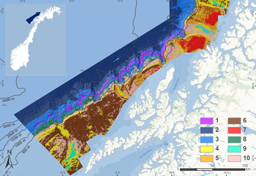
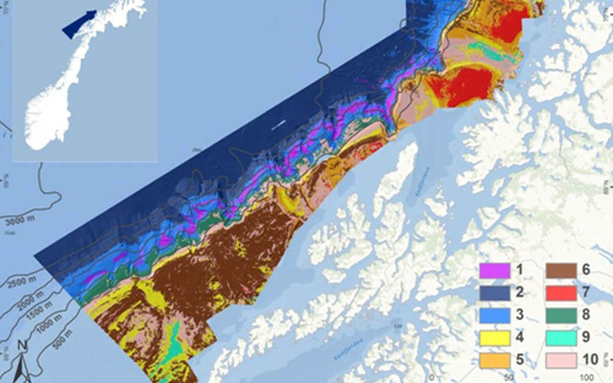
The new report describes a simulated case study using alternative bathymetry data combined with multibeam data covering selected areas only, extracted from the full MAREANO dataset. The simulated study uses this combined bathymetric dataset as the basis for sediment and habitat mapping, and the results are compared directly with published MAREANO results from the same area based on full coverage multibeam data. The alternative bathymetry data were provided by Olex AS, a company that produces chart plotters and compiles bathymetry data from users of their system (often fishing vessels using single beam echosounders).
The main conclusion of the report is that under certain circumstances it is possible to produce regional sediment and habitat (biotope) maps at a mapping scale of 1:250 000 or coarser (MAREANO published standard is 1:100 000) based on Olex data, if these data are supported by limited multibeam mapping. There are however significant limitations to this type of dataset, for example the data examined showed that in most cases it was not possible to detect small topographic features such as coral reefs. Olex data within the study area also contain no information on acoustic backscatter, a signal from echosounder data that can give an indication of the nature of the sediments, and which is a very useful dataset both for optimal planning of biological/geological sampling, and for geological interpretation in MAREANO.
Based on the results of this study testing Olex data it is possible to envisage two levels of detail for MAREANO map production maps at 1:100 000 scale in areas with full coverage multibeam; and maps at 1:250 000 scale in areas where there are good alternative multibeam data from Olex or other sources. If required it would also be possible to produce maps with higher resolution (e.g. 1:25 000) in areas of special interest, provided that good multibeam data are available.