
Acoustic backscatter
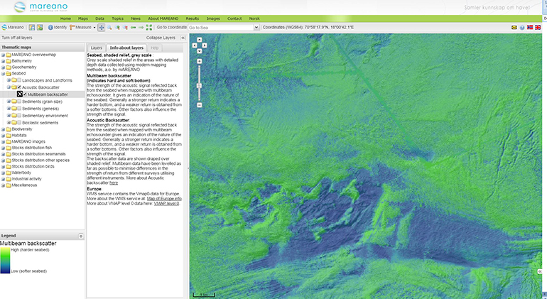
Multibeam backscatter data
While ship-borne multibeam echosounders acquire MAREANO bathymetry data by pinging the seafloor with sound waves and detecting the return, they simultaneously acquire acoustic backscatter data. Unlike bathymetry measurements, which rely on the timing of the echo to estimate depth, acoustic backscatter relies on the intensity of this echo. More precisely acoustic backscatter is a measure of the acoustic energy returned to the multibeam receiver after a complex interaction of the incident sound with the seafloor and its journey through the water column.
Despite these complex geophysical processes acoustic backscatter is helpful in determining seafloor geology (i.e. mud, sand, gravel etc.), since different types of seabed scatter sound energy differently. Multibeam echosounders operating at different frequencies and with different acquisition setups will not capture exactly the same properties of the seabed. Nevertheless analysis of MAREANO data to date have shown that backscatter data generally correspond well with seabed observations from video or physical samples, and the backscatter data are invaluable in the production of sediment maps. We note, however, that backscatter data should not be considered a direct proxy for bottom type, and need to be supported by ground truth observations.
Contact