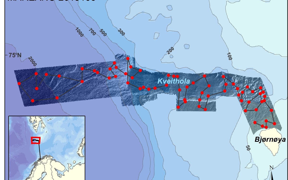
Map showing the stations (red dots) surveyed during the current MAREANO 2019106 cruise with the sailing course indicated. Bathymetry data are shown as a shaded relief image within the area covered by multibeam data from MAREANO and the University of Tromsø. Inset map shows the location of the study area near Bjørnøya and sailing path from Tromsø. Figure: MAREANO.
MAREANO cruise summary: To Bjørnøya, beyond, and beneath!
Saturday 6th April, a crisp, bright morning in Tromsø and 15 scientists and engineers from the Institute of Marine Research (IMR) and the Geological Survey of Norway (NGU) join the crew onboard G.O. Sars and set sail for Bjørnøya (Bear Island), where we will survey an area of around 4 500 km2 extending as far as 75°N in the western Barents Sea and Norwegian Sea.
Published: 26.09.2019Updated: 19.04.2022
This is the first MAREANO cruise of 2019 and will see biologists, geologists and chemists working together onboard to video the seabed and collect samples of the sediments and seabed-dwelling animals between 30 and 2200 m water depths. The data will be used together with multibeam bathymetry and backscatter data recently acquired by our MAREANO partners Kartverket and legacy multibeam data from the University of Tromsø. These data allow us to not only ‘see’ the shape of the underwater terrain, but also to gain an impression of whether the seabed is soft or hard and how rugged it is. The bottom types will be verified by the data acquired on this cruise, together with information on which animals inhabit the sea floor and its environmental status. The new knowledge acquired by this, along with other MAREANO surveys, provides important information that helps facilitate the sustainable management of Norwegian sea areas.
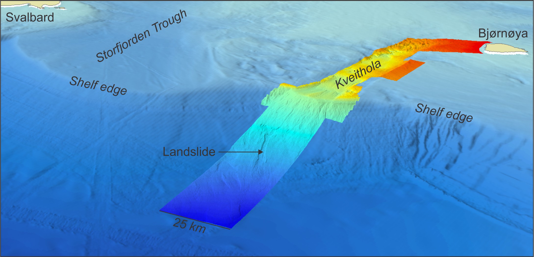
3D overview of the survey area traversing the shelf edge near Bjørnøya in the western Barents Sea into the deep Norwegian Sea. High resolution multibeam bathymetry data are shown as colour shaded relief with a scale from red (~20 m water depth) to blue (~2200 m water depth) acquired by MAREANO and University of Tromsø. Background regional bathymetry data from EMODnet (www.emodnet.eu). Figure: MAREANO/ NGU.
By Sunday evening, after sailing northwards for over 24 hours we arrive at the first station ready to deploy the video rig “Chimaera” for the first dive of the cruise in near perfect weather conditions. The first few days of work are jam packed with video surveys from the shallow waters to the north of Bjørnøya, where we observe many sandy high energy habitats and even a 257 million year old fossil!
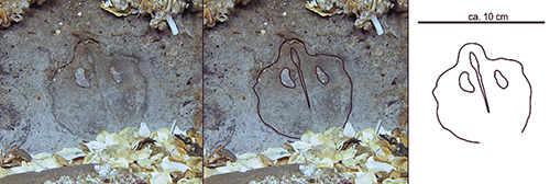
Amongst shell debris in about 40 m water depth we find the clear imprint of a brachiopod fossil thought to be around 275 million years old. Figure: Frank Jakobsen/MAREANO.
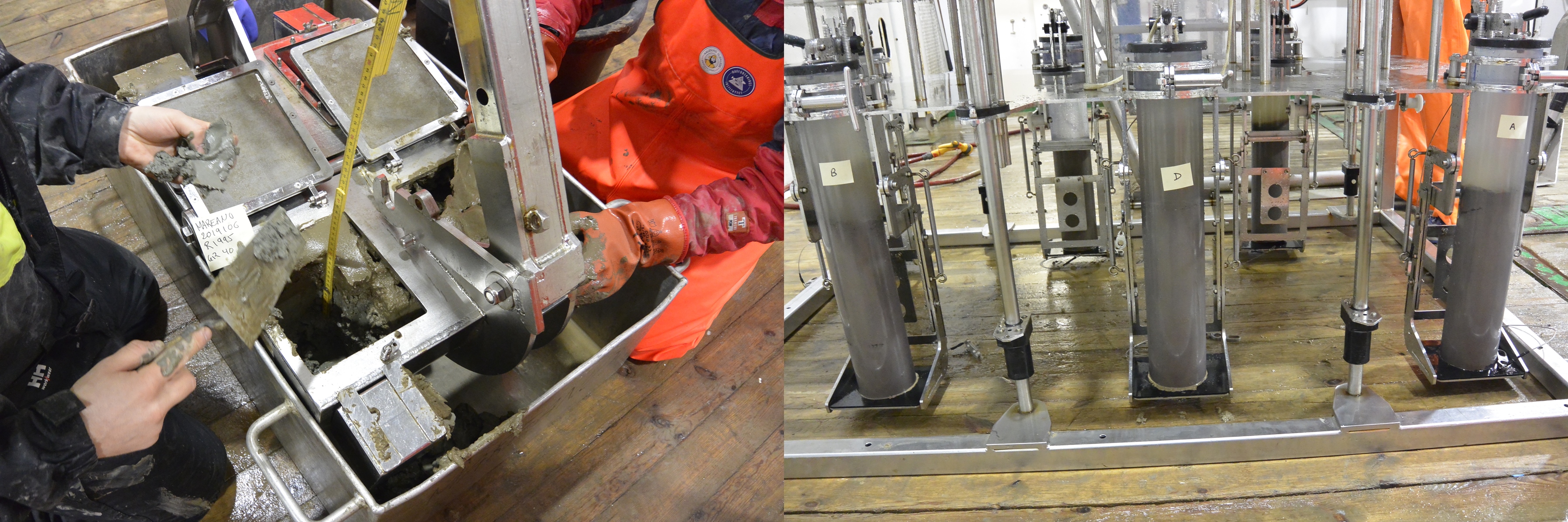
Once outside the protected area around Bjørnøya we start supplementing our video observations with physical samples of the seabed. Several grab samples are taken so that MAREANO geologists can verify grain sizes (sand, mud etc.) observed in video footage. At selected stations a full suite of complementary sampling is conducted to contribute to the MAREANO database. The images below give a flavour of some of the equipment used and samples obtained.
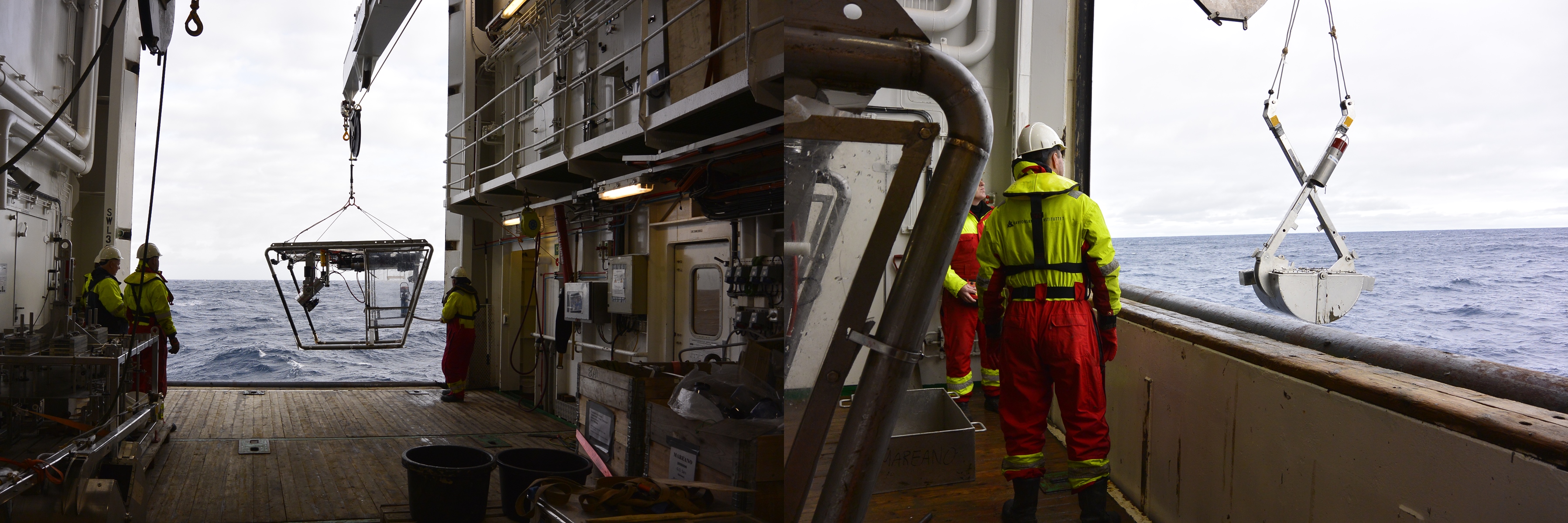
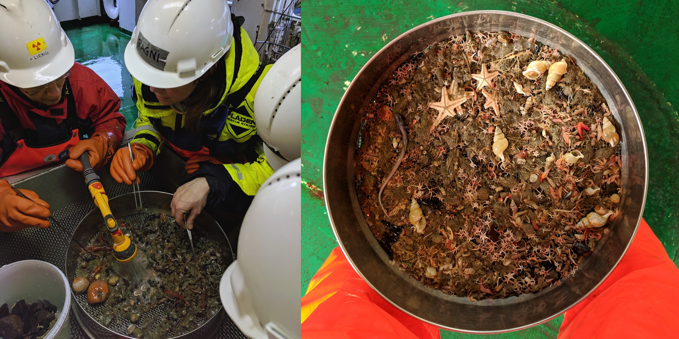
Deploying and retrieving much of the equipment is done from the spacious hanger on G.O. Sars. Here we see video rig “Chimaera” (left) and the grab sampler (right) Photos: MAREANOGrab samples (left) and multicorer (right) provide information on sediment type geochemistry and environmental status including microplastic content. Some grab samples are reserved for analysis of the animals living within the sediments. Photos: MAREANOAfter all the hard work of sieving away mud and stones and picking through the animals (right) is complete, we end up with a sieve full of starfish (Asteroidea), brittlestars (Ophiuroidea), shrimp (Caridea), snail shells (Gastropoda) and even a small fish (Lumpeninidae) (right). Photos: Rebecca Ross.
As we move further west from Bjørnøya into the deeper water habitats of the Kveithola Trough we see how rapidly the habitats change over a short distance as we move away from high energy, current swept shallow waters where many animals are prominent in video images into a calmer environment where more animals make their home within the sediment, less visible on video but clear to see from physical samples.
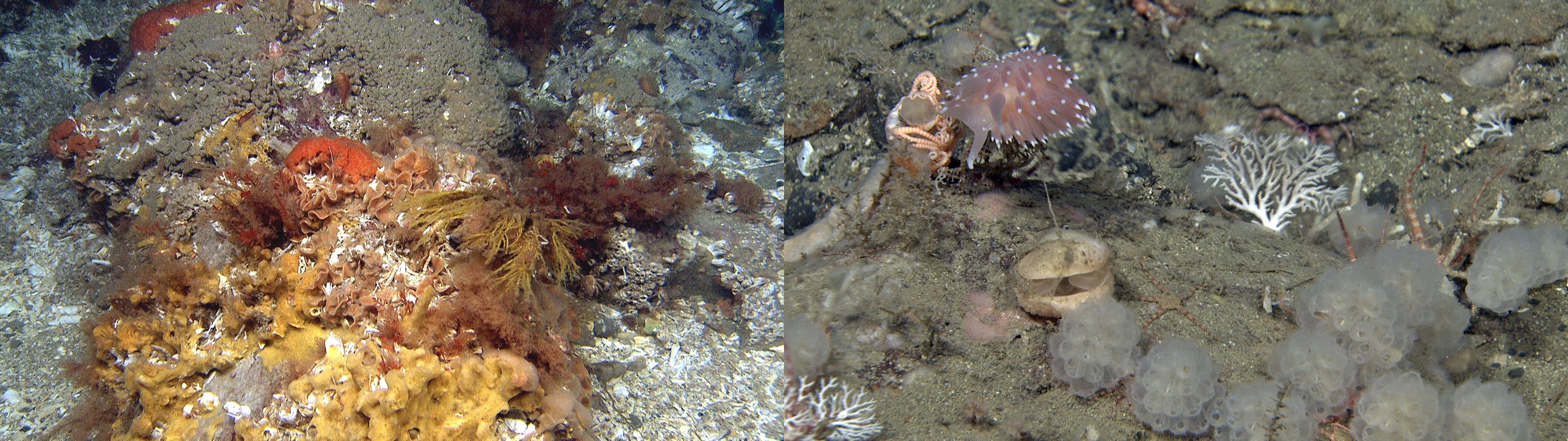
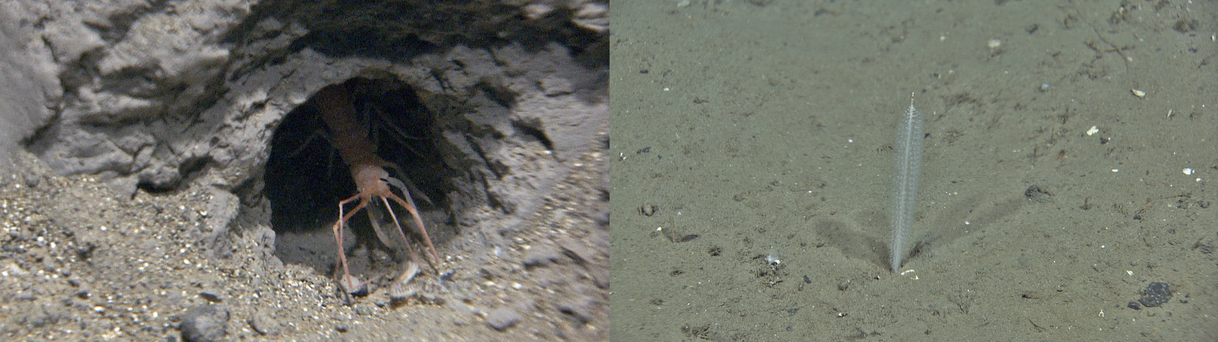
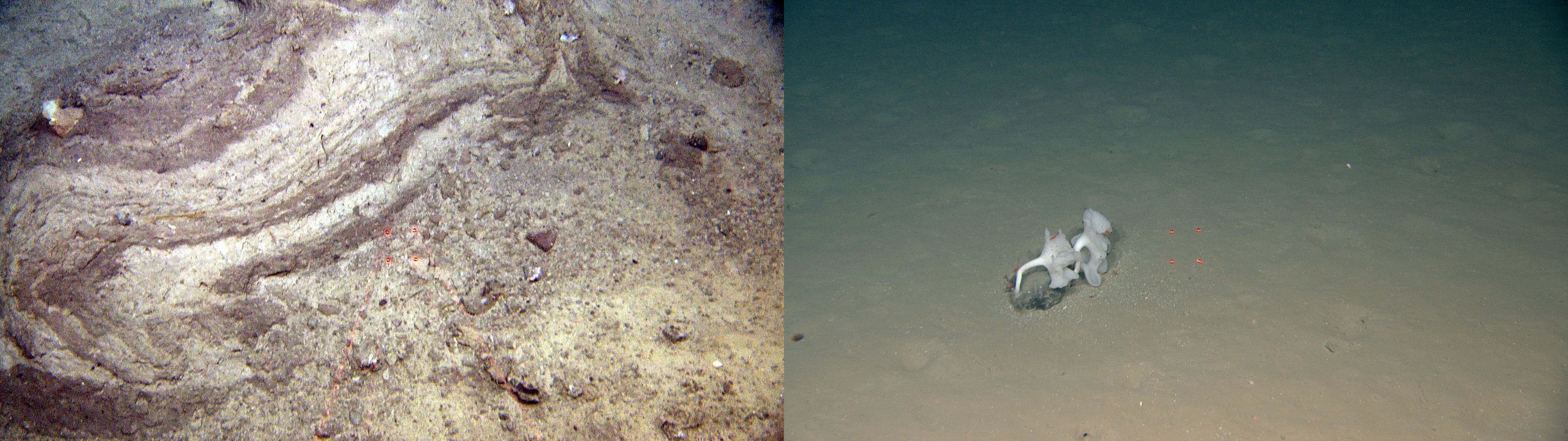
Images from shallow water around Bjørnøya: A colourful scene with encrusting sponges (Porifera), bryozoans and hydroids which was frequently encountered (left) and a miniature oasis (right) showing close up footage of a sea slug (Coryphella sp), small basket star (Gorgonocephalus sp), a brachiopod, sea squirts (Kukenthalia borealis) and some stylasterid hydrocorals. Photos: MAREANOImages from intermediate depths in the Kveithola Trough: A rare glimpse of a giant amphipod crustacean (Neohela sp) as it chases a worm (Phyllodocidae sp) out of its burrow (left) and a muddy seabed (right) with a delicate sea pen (Virgularia miriabilis) which was frequently observed in Kveithola Trough. Photos: MAREANOImages from the slope and deep water: A block with layered, soft sediments from the top of the landslide area that has been deformed and folded as it has slid down the slide scar (left), and a deep muddy bottom at 2000 m inhabited by the ‘chanterelle’ sponge (Caulophacus sp) and many burrowing animals (right). Photos: MAREANO.
As we reach the shelf break and deeper waters below 500 m the remoteness of the seabed hits home as all the equipment takes longer to deploy to and from the seabed. Nevertheless, it’s all systems go as we continue to work 24 hours a day to gather more video and sample material from the slope, including from an underwater landslide. Some areas here have clearly been recently trawled and we can see several fishing boats around us, likely in search of cod.
Whilst we are sampling at just over 1000 m depth, however, the good weather we have enjoyed since arriving in the area almost exactly a week ago, breaks. As the waves grow steadily higher, the white horses roll, and the ship sways, all deck operations are put on hold for around 24 hours. By Monday morning the seas have calmed a little and, although seas are too rough to deploy the video rig, grab sampling can continue allowing geologists to verify which sediment types our multibeam backscatter data correspond to, as well as taking some surface samples for geochemical analysis. After a few more hours with grab sampling the conditions are finally calm enough for the video rig to dive again. Some more stormy weather is forecast which looks to threaten the rest of our sampling programme and send us back to port, but lady luck is on our side and we manage to escape without any major further loss of survey time.
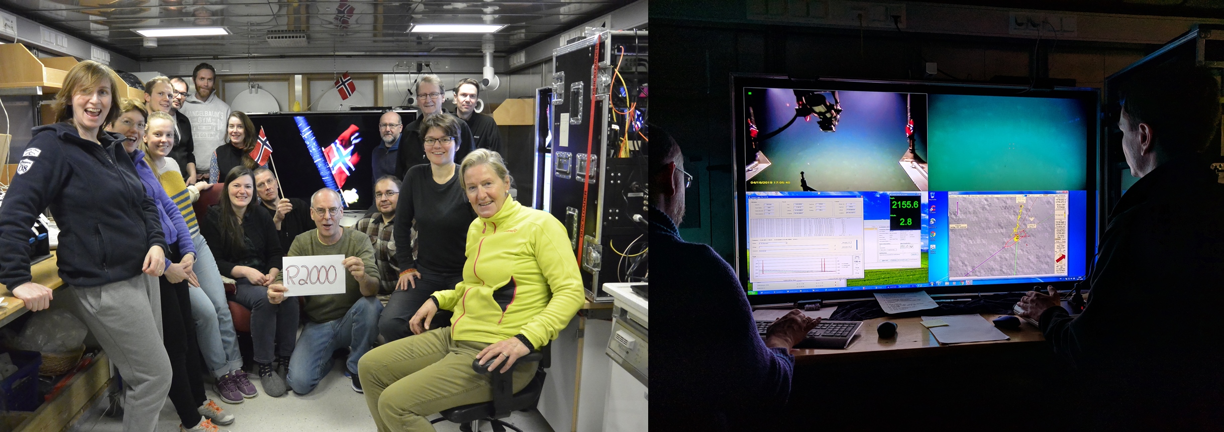
MAREANO has not conducted video and sampling in deep waters since 2012 but we enjoy several video dives to over 2000 m in the last days of the survey, as well as completing our planned geochemical programme with a final multicore sample. One event worthy of particular celebration was MAREANO’s 2000th station at around 2160 m, the video rig was even decorated for the occasion and spirits on board were high.
Station R2000 celebration: (left) The scientific and technical team gather in the video room to celebrate the deployment of the video rig at MAREANO’s 2000th station, complete with Norwegian flags and an Easter chick onboard! (right) The video reaches the seabed and is ready to start being towed along the video line, with geological and biological observations being logged along the way. Photos: MAREANO and Rebecca Ross.
During the last day of survey operations, we have conducted the final video surveys, albeit with a bit of prioritizing of stations to fit the time available. We also managed to return to complete some important unfinished stations where we were originally unable to deploy certain equipment due to bad weather. Overall, given the time of year we have been very fortunate to have come so far with the survey operations and have gained a good impression of the seabed and its inhabitants across the whole area. Now it is time to set sail for Tromsø and enjoy a well-earned break over the Easter weekend.
MAREANO wishes to thank the Captain and crew of G.O. Sars as well as the IMR instrument technicians. We look forward to more video and sampling surveys later in the year when the MAREANO team will set sail again.
For further details from this cruise please see the following news articles on MAREANO’s Norwegian pages: