New sensor platforms, such as autonomous vehicles and drones, open up new possibilities for mapping the terrain, sediments and habitats in shallow waters and the foreshore. In June MAREANO teamed up with NTNU-AMOS to test out unmanned and autonomous platforms for interdisciplinary mapping.
Published: 01.07.2019Updated: 07.12.2022Author: Sissel Kanstad, the Norwegian Mapping Authority Hydrographic Service
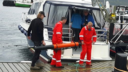
AUTONOMOUS UNDERWATER VEHICLE: The AUV "Harald" is prepared for the expedition of the day and taken on board the boat "Lophelia". Photo: Sten-Richard Birkely
During the mapping expedition a variety of platforms both on, under and over the water, were tested, as well as a range of different scientific equipment and sensors. The MAREANO programme is particularly interested in the testing of video systems and multibeam echosounder on various platforms.
The area around Runde is a very good test area since a good deal of marine mapping is already taking place in the area, and because the Norwegian Armed Forces have released detailed bathymetric data for much of south Sunnmøre. Most of the data in coastal Norway are subject to military restrictions.
Autonomous mapping on Svalbard?
During 2017 and 2018 the MAREANO programme will undertake bathymetric mapping using multibeam echosounders in Svalbard. This will be followed by a geology, biology and chemistry mapping expedition to conduct video surveys and sampling of the seabed.
The programme aims to map close to shore and in shallow waters in Kongsfjorden on the west coast and in Rijpfjorden on Nordauslandet. With this in mind MAREANO is interested in how USVs (Unmanned Surface Vehicles), AUVs (Autonomous Underwater Vehicles) and small Remotely Controlled Vehicles (ROVs) can contribute to this mapping. These platforms can potentially provide better access to shallow waters and close to glacier fronts, which are difficult to access with standard boat-based surveys. Use of these platforms may well help make the mapping more effective than by relying on more traditional methods.
– This test expedition on Runde provides a good opportunity for MAREANO to evaluate both the practical side of operating with these autonomous and unmanned platforms as well as assessing the quality of the collected data. The results will directly contribute to the planning of further mapping on Svalbard in 2018, says Hanne Hodnesdal, project leader for MAREANO at the Norwegian Mapping Authority Hydrorgaphic Service.
– We want to map the two fjords on Svalbard to provide thorough documentation of the present-day environmental conditions there. Research has indicated that Kongsfjorden is already affected by climate change, while Rjipfjorden is believed to be affected to a far lesser extent, says Terje Thorsnes, project leader for MAREANO at the Geological Survey of Norway.
Representing the MAREANO programme on this expedition were Øyvind Tappel (Norwegian Mapping Authority Hydrographic Service), Margaret Dolan (Geological Survey of Norway), Terje Thorsnes (Geological Survey of Norway) and Sten-Richard Birkely (Institute of Marine Research).
REMOTLEY OPERATED VEHICLE: NTNU and the Institute of Marine Research get ready to test the mini ROV "Blueye". Photo: Margaret Dolan
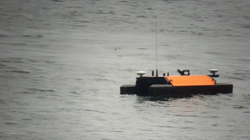
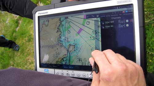
OTTER: The USV "Otter" in action. Photo: Sten-Richard Birkely
IN ACTION: "Otter" is followed by Arild Hepsø from Maritime Robotics. Photo: Øyvind Tappel
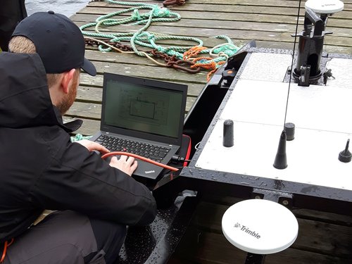
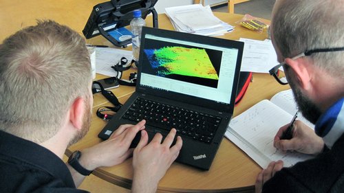
CALIBRATION: Christian Malmquist (NTNU) and Thomas Rygh (Norbit) looking through the calibration report after the first day of the expedition. Photo: Øyvind Tappel
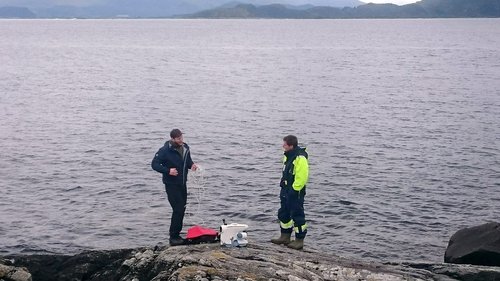
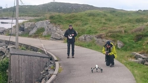
DRONE: Geological Survey of Norway and Maritime Robotics were testing use of drones. Photo: Margaret Dolan