Contact
Biological mapping
Børge Holte
+47 77 60 97 53
Geological mapping
Terje Thorsnes
+47 73 90 42 75
Bathymetry
Hanne
Hodnesdal
+47 51 85 88 23
Information officer
Beate Hoddevik Sunnset
+47 55 23 85 16
Published: 28.01.2007 Updated: 24.10.2019
 Norwegian waters cover a total of over 2 million
km2. As of today, the knowledge about the seabed in our
waters is limited. In fact, we know far more about the surface of
the planet Mars than about the seabed right outside our coastline!
In 2005, the Norwegian government allocated NOK 5 million for the
first phase of an interdisciplinary programme, MAREANO, which aims
to map and study the seabed in Norwegian waters initially
focusing on environmentally sensitive areas of the Barents
Sea.
Norwegian waters cover a total of over 2 million
km2. As of today, the knowledge about the seabed in our
waters is limited. In fact, we know far more about the surface of
the planet Mars than about the seabed right outside our coastline!
In 2005, the Norwegian government allocated NOK 5 million for the
first phase of an interdisciplinary programme, MAREANO, which aims
to map and study the seabed in Norwegian waters initially
focusing on environmentally sensitive areas of the Barents
Sea.
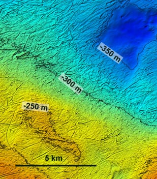
The MAREANO survey started in October 2005, and the first areas of the Tromsøflak have now been charted. Kjersti Hovemoen of the Norwegian Defence Research Establishment was chief scientist on board R/V H.U. Sverdrup. In spite of autumn storms, we managed to produce high-quality chart data for about 1000 km2", she says. "The programme also included tests of methodology and of various types of instrumentation that will be used in the MAREANO survey programme. The main instrument was a multi-beam echosounder that provides a detailed picture of the seabed terrain.
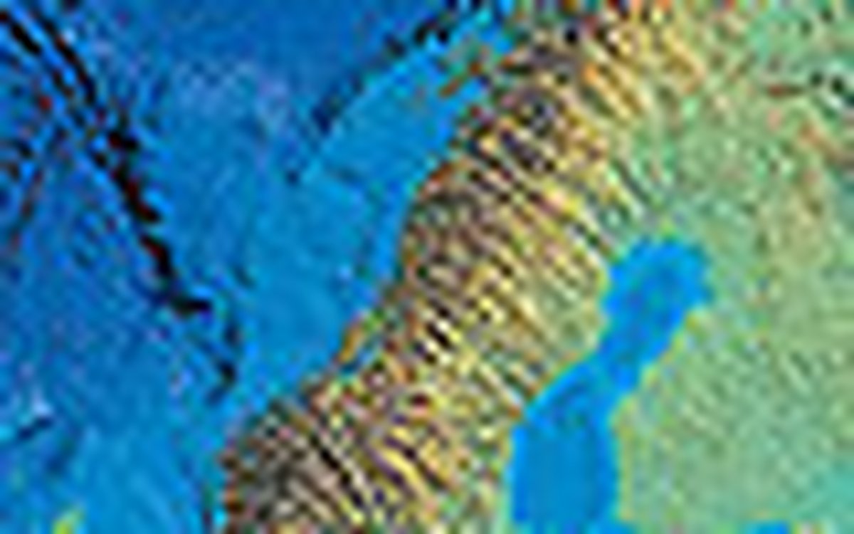
The first charts produced from this survey show an irregular underwater landscape with many depressions and ridges. Most of the seabed has a furrowed appearance, with irregular depressions that are often several metres deep and many kilometres in length. These are the marks left by icebergs that drifted around the Barents Sea after the ice that covered the whole of the continental shelf retreated to the mountains more than 10,000 years ago, says Terje Thorsnes, a scientist with the Geological Survey of Norway (NGU). In some small areas we can also see gas pockmarks; round depressions that may indicate that gas or liquid has seeped out of the ground in the past.
Plough-marks left by icebergs can clearly be seen on the seabed
in the form of long irregular depressions. In the deepwater area at
top right, the seabed is more even, because sediments have
collected here. We can also see pockmarks in this region.
In 2006, the activity level of the MAREANO Programme will pick up, when large areas of the seabed of the continental shelf will be charted in detail. There will be a sampling cruise to study seabed conditions and marine biology on the Tromsøflak, and we will begin production of marine charts of the coastal zone, says MAREANO coordinator Ole Jørgen Lønne of the Institute of Marine Research (IMR). At the same time, IMR, NGU and the Norwegian Hydrographic Service will process existing information and integrate it into open-access databases.
MAREANO is carried out by IMR, the Norwegian Hydrographic Service and the Geological Survey of Norway in cooperation with other national research institutes and directorates. The total costs of the Programme in the Lofoten and Barents Sea region will be around NOK 235 million.